
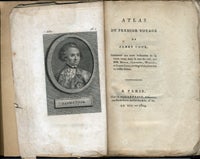
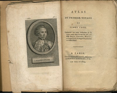
Atlas du Premier Voyage de James Cook, Contenant une carte indicative de la route tenue dans la mer du sud, par Mm. Byron, Carteret, Wallis, et James Cook; et vingt-trois planches en taille-douce.
Paris: Chez la veuve Lepetit, 1804. Hardcover. A scarce French children's edition of Cook's first voyage, sadly, the atlas volume only. This edition not listed in Beddie, nor does it appear that this edition is in the National Library of Australia. Beddie, Bibliography of Captain James Cook. 2nd ed. no. 66 lists the 1804 Breton's edition, which is a "Traduction nouvelle par J.B.J. Breton". On his first voyage, Cook discovered & charted the East coast of Australia. Large 12mo, 17 cm, b&w portrait frontis of Cook, 8pp, folding map & 23 b&w plates. Original red wrappers bound in, along with what looks to be a spine label for "Bibliotheque Portative des Voyages Tome Dix-Huit". Some corners a little ruffled, wrappers a little ruffled and creased with corner loss to front wrapper. Black cloth binding with gilt title & rules, possibly 19th century, in very good condition. Item #12990
Sold