
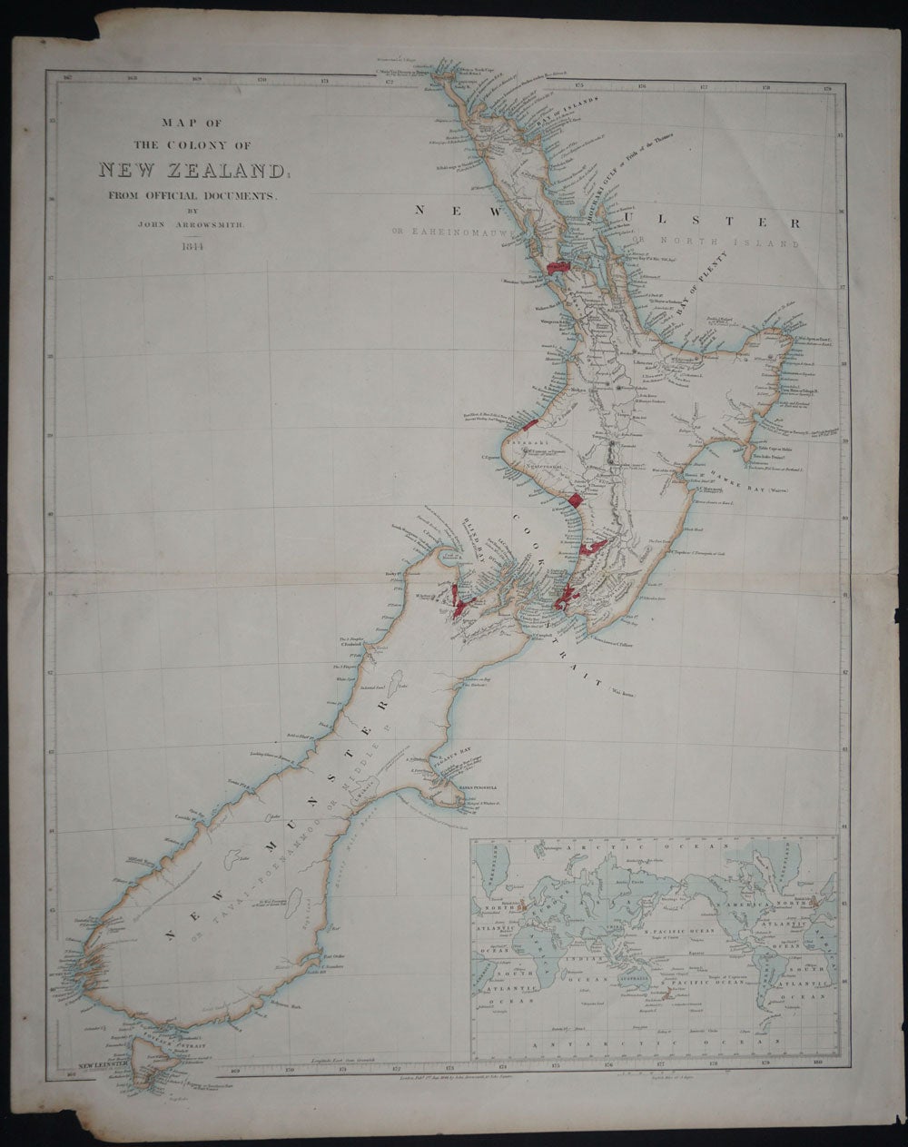
Map of the Colony of New Zealand; From Official Documents.
London: J. Arrowsmith, 1844. London, Pubd. 2nd Jan 1844 by John Arrowsmith, 10 Soho Square. From the 1844 edition of "The London Atlas". Inset in the lower right corner of the world on Mercator projection. Orig. outline & wash color, six areas marked in red including Auckland, New Plymouth, Petre (R. Wanganui), Wellington, Palmerston North and Nelson. The South Island is largely unexplored. In Arrowsmith's usual way, the explored areas are heavily annotated, all rivers & mountains known are charted, and any information pertinent to exploration or settlement are noted, i.e., "extensive grass plains dotted with groves of pine trees", or "high craggy mountainous land topped with snow", to name a couple from the South Island. Measures 24.8" x 19.6", center fold, slt fox spotting at left outer edge not affecting map, otherwise clean. Item #12061
Price: $2,750.00