
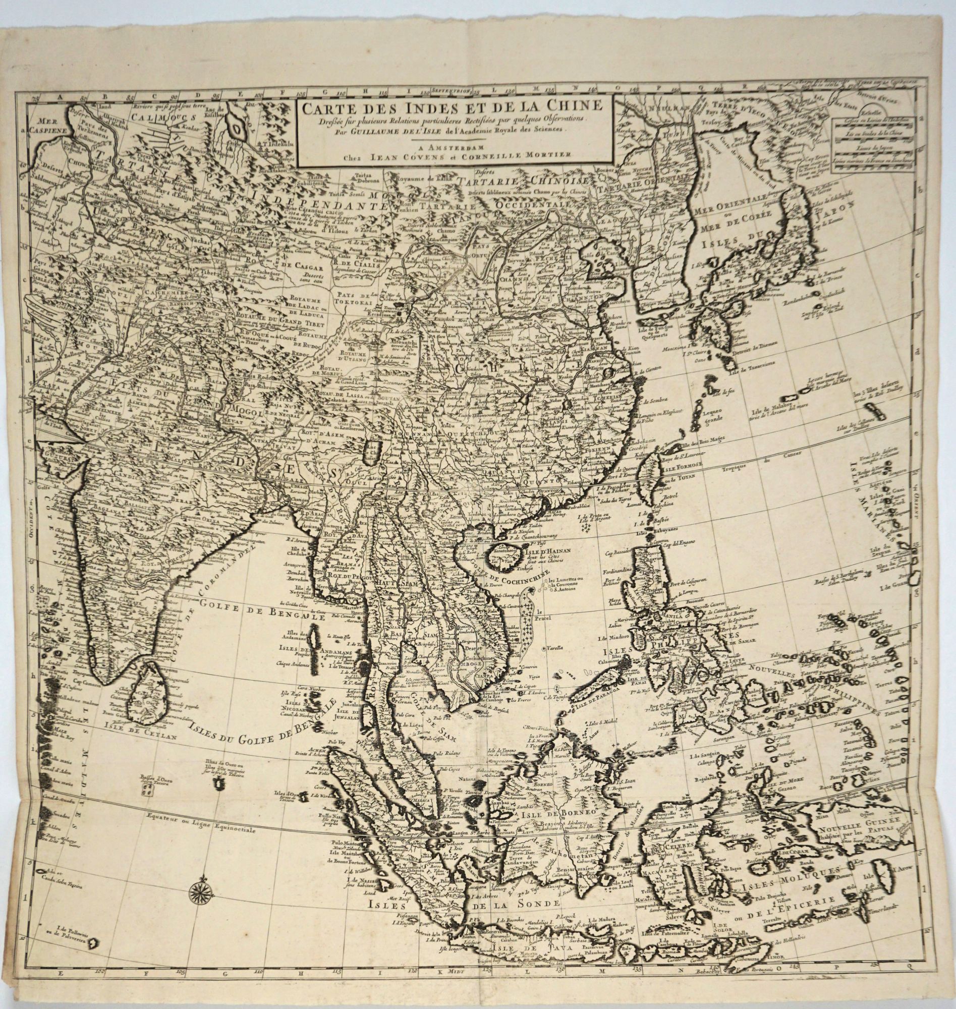
Carte des Indes et de la Chine / Dressée sur plusieurs Relations particulieres Rectifiées par quelques Observations par Guillaume de l'Isle de l'Academie Royale des Sciences. Map.
Amsterdam: Chez Jean Covens et Corneille Mortier, Ca. 1720. A fine example of this highly detailed map of the Far East covering from Japan and Southeast Asia to Uzbekistan and India. Areas mapped include China, India, Japan, New Guinea, Timor, Taiwan, Malaysia, Thailand, Vietnam, Burma, Philippines, Sri Lanka and many of the "Stans" in the west. The map is based on the earlier work of Guillaume De L'Isle.
Covens & Mortier specialized in publishing French geographers including De L'Isle, Jaillot, Janssonius, and Sanson. They also reissued atlases, for example a 1725 reissue of Frederik de Wit’s Atlas Major and an atlas, with additions, from the works of Guillaume De L'Isle. They also purchased Pieter van der Aa’s plates in 1730. At their high point, they had the largest collection of geographic prints ever assembled in Amsterdam.
Handsome copper engraving, b&w as issued, 24 x 24 1/4", two original folds, bright and clean. Very good condition. Item #13335
Sold