
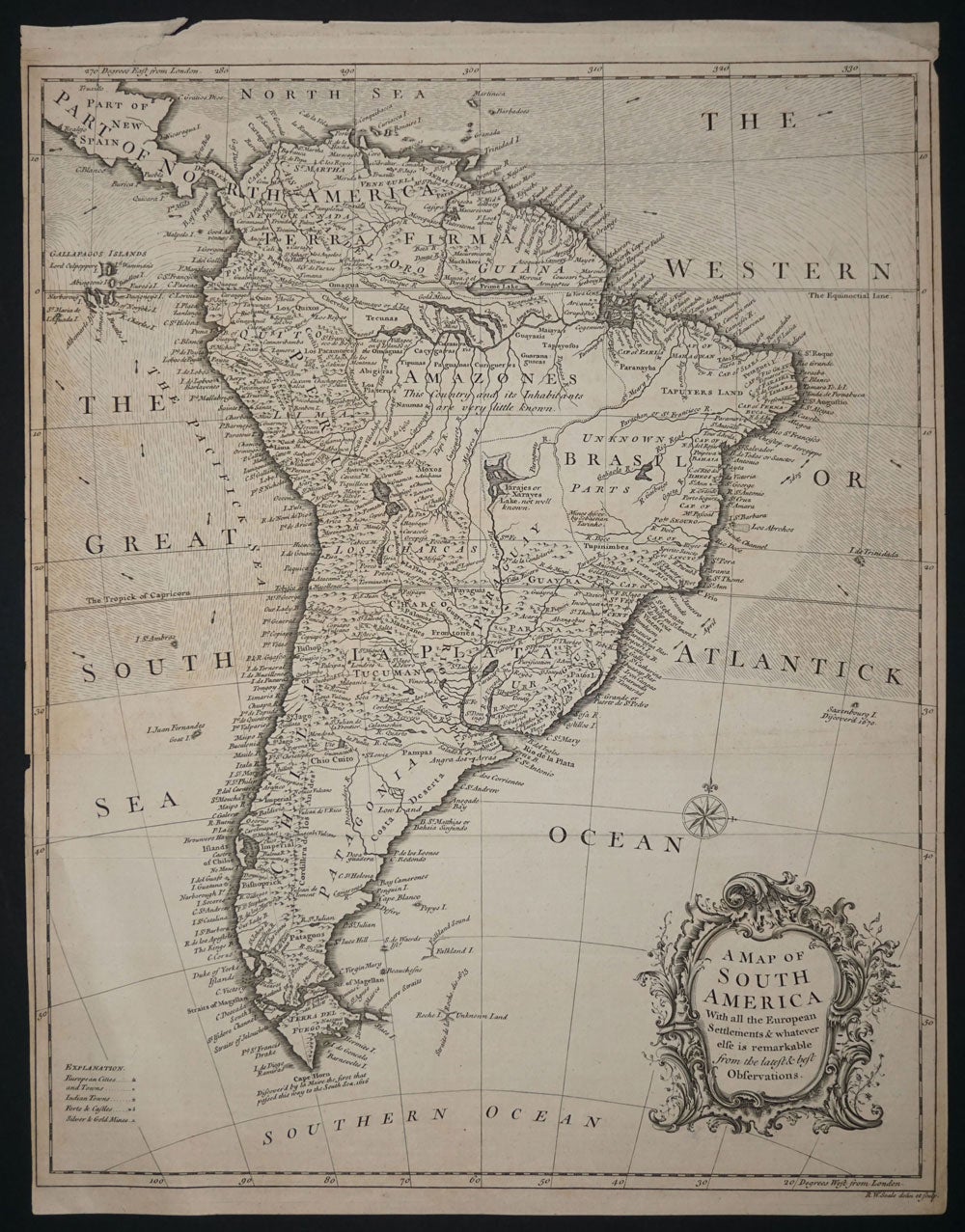
A Map of South America with all the European Settlements & whatever else is remarkable from the latest & Best Observations.
London: c. 1740. A large & attractive map of South America, ca. 1740. Quite a lot of interior detail including moutain ranges, cities, rivers, the "Great Road of the Incas". The interior of Brasil is " Unknown Parts" and the Amazones is described "This County and its Inhabitants are very little known." Copper engraving, 37.5 x 46.8 cm with margins, printed on heavy laid paper. Sml. closed margin tear, ion. Small key in the lower left corner gives the symbols for European Cities, town, Indian Towns, Forts & Castles & Silver & Gold Mines. With wind directional markings in the sea from 30 degrees south up to the Equator. Looks very like a Kitchin map. Item #14242
Price: $450.00