
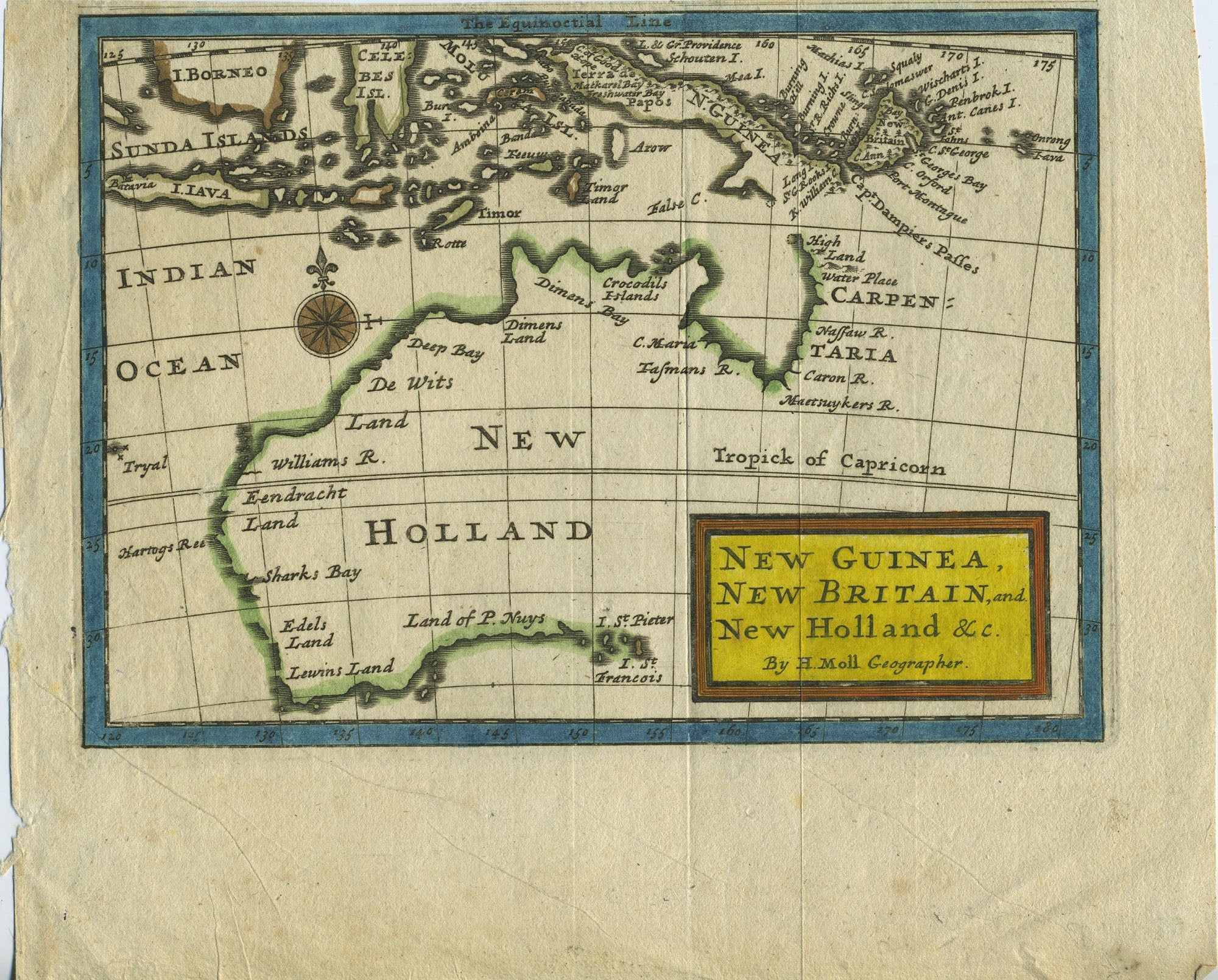
Map of Australia entitled "New Guinea, New Britain, and New Holland &c." from the Atlas Geographus: or, a Compleat System of Geography, (Ancient and Modern) for America. Containing What is of most Use in Bleau, Varenius, Cellarius, Cluverius, Luyts, Baudrand, Sanson, the Royal Commentaries of Peru, &c...
London: Eliz. Nutt for John Nichoson, 1716. This Moll map of Australia entitled "New Guinea, New Britain, and New Holland &c.", is one of the earliest English maps devoted to the Australian continent (Tooley p 122, no 90). The map shows Australian locations named Carpentaria, Dimens Land, De Wits Land, Eendracht Land, Edels Land, Lewins Land, and Land of P. Nuys. At the top of the map can be seen N. Guinea and the Sunda Islands. Image size 7 x 5". With later outline color and title block in yellow with red border. Trimmed close at the top (leaving 1/8" margin) and with 1 1/2" bottom margin. One original fold line, very good. Item #14414
Price: $750.00
See all items in
COOK, JAMES,
MAPS
See all items by Herman Moll, James Cook