
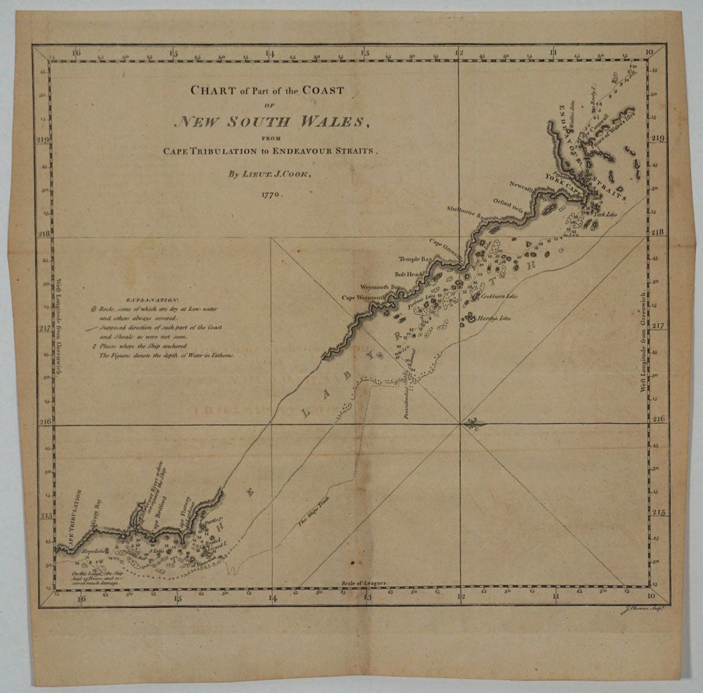
Chart of Part of the Coast of New South Wales from Cape Tribulation to Endeavour Straits. By Lieut. J. Cook, 1770.
London: 1770. The first printed map to concentrate on a section of Australia's east coast, from the 1st edition of Cook's Voyages. Shows the Queensland coast from Cape Tribulation to the Endeavour Straits, with the ship's track. Copper engraved map, 34x30 cm. Original folds, very lt. browning on the center fold from the tab, a very nice copy. Item #14537
Price: $750.00
See all items by James Cook