
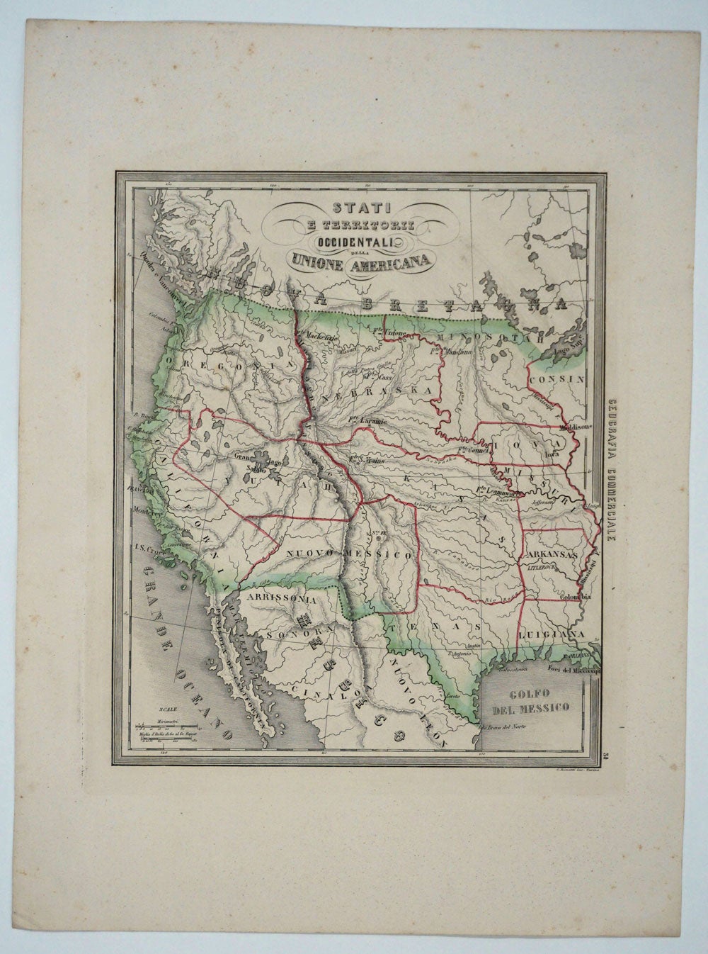
Stati e Territorii Occidentali della Unione Americana.
Genoa: Paolo Rivera, 1858. Map of the Western United States in an interesting configuration. California, Oregon, Nebraska, Kansas, New Mexico and Utah are oversized, totally eclipsing Washington, Idaho, North & South Dakota, Montana, Oklahoma & Colorado, who are not named. "Arrisssonia" is on the Mexican side of the border. The eastern border of the map shows Minnesota (slightly out-size), Iowa, Missouri, Arkansas & Louisiana more or less to current borders. Louisiana named "Luigiana". With the lakes shown oversize, including Gran Lago Salato". Some cities noted, but more often Forts - Fort Leavenworth, Connci, St. Vrains, Laramie, Mackenzie. From the "Geografia Commerciale". Steel engraving with attractive original outline color, printed on thick paper with wide margins, 33 x 28 cm (hxw). Very good condition. Item #15318
Price: $750.00