
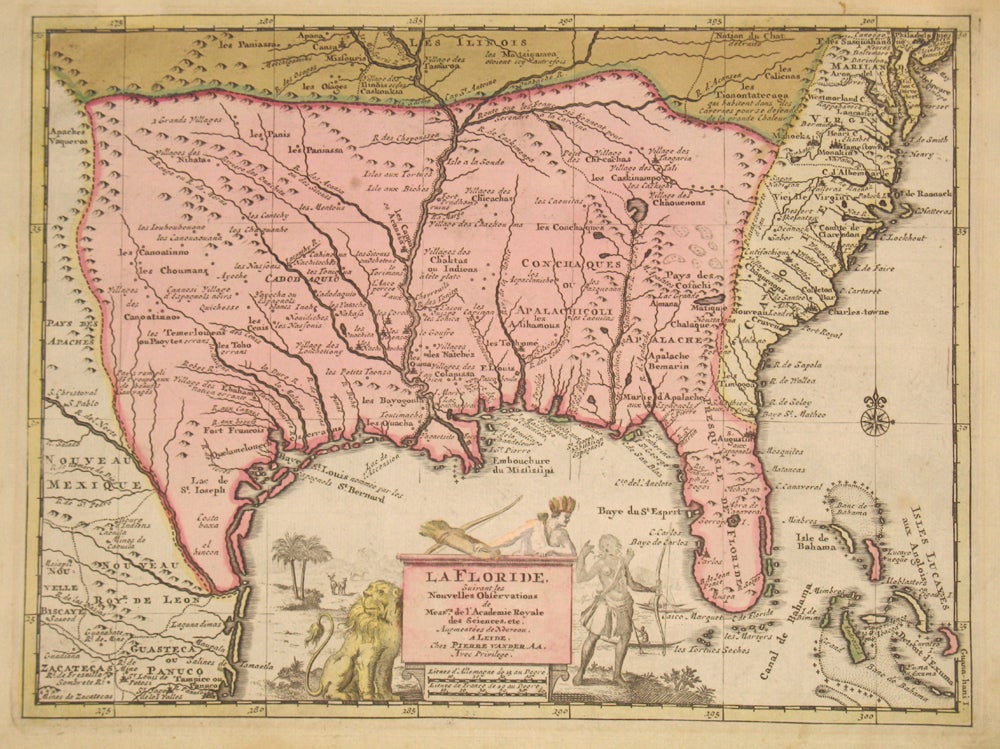
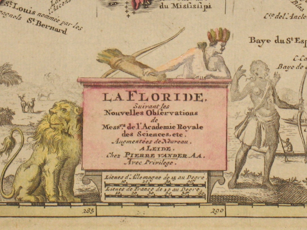
La Floride, Suivant les Nouvelles Observations de Messrs. de l'Academie Royale des Sciences, etc. Augmentees de Nouveau. A Leide chez Pierre vander Aa. Avec Privilege.
Leyden: 1713. First edition. Rare and important original color map of southeast North America, from Maryland and Illinois in the north (including Philadelphia) to Mexico in the south and the Bahamas in the east. Noted for its great detail, with Native American villages, mountains and rivers, and English, French and Spanish settlements. With the Mississippi River very clearly defined, but depicted too far to the west; Florida with a slightly blunted peninsula, with St. Augustine named. Title cartouche embellished with Native American figures, a lion, deer and figures in canoes. From 'Le Nouveau Theatre du Monde', and based on Delisle's important Carte du Mexique de la Floride of 1703. Cumming (155) lists its title as "La Florida(sic)...." and dates it 1713. 11 3/4 x 9". A slightly light impression on the female Native American figure. With old color, possibly early. Without fold marks, very good. Cumming, W.P. (SE) 155. Item #15687
Price: $1,350.00