
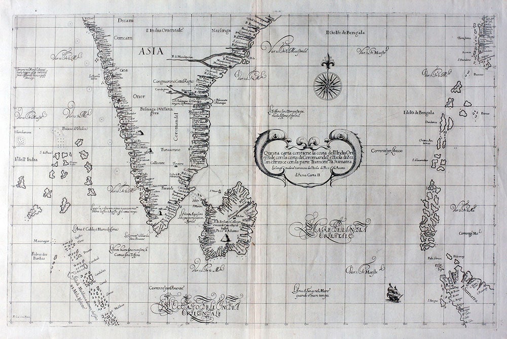
Questa Carta Contiene la Costa dell'India Orientale con la Costa di Coromandell e l'Isola di Zeilan e Finisce con la Parte Tramontna. di Sumatra. D'Asia Carta II.
Florence: Nella nuova stamperia per Guiseppe Cocchini all'insegnia della stella, 1646. First edition. Fine engraved map showing the southern half of the subcontinent of India with the island of Sri Lanka, and extending to Sumatra in the east and the Maldives in the south. From "Dell'arcano del mare", (Plate [77] volume 2,) Dudley's maritime masterpiece written in Italian and which represented the sum of knowledge of his life of navigation, seafaring and engineering. The sixth part of the encyclopedia, the maritime atlas, was a pioneering achievement, remarkable in its originality: it was the first nautical atlas of the entire world, the first by an English man, and the first to use the Mercator Projection throughout and the earliest earliest to show the prevailing winds, currents and magnetic deviation.
Elegantly engraving by Antonio Francesco Lucini with a Baroque dolphin motif at the cartouche. With place names "L'India Orientale", "Asia" and "Coromandell" at the east coast of the continent. The coast line of the continent is punctuated with numerous water courses, creating a lace like effect. In excellent condition, bright and clean. Image size 30 x 19 1/4", paper size 32 3/4 x 22". OCLC: 225562751. Suarez, Early Mapping of South East Asia, p.207; Burden, "The Mapping of North America", p.338. Item #15836
Sold