
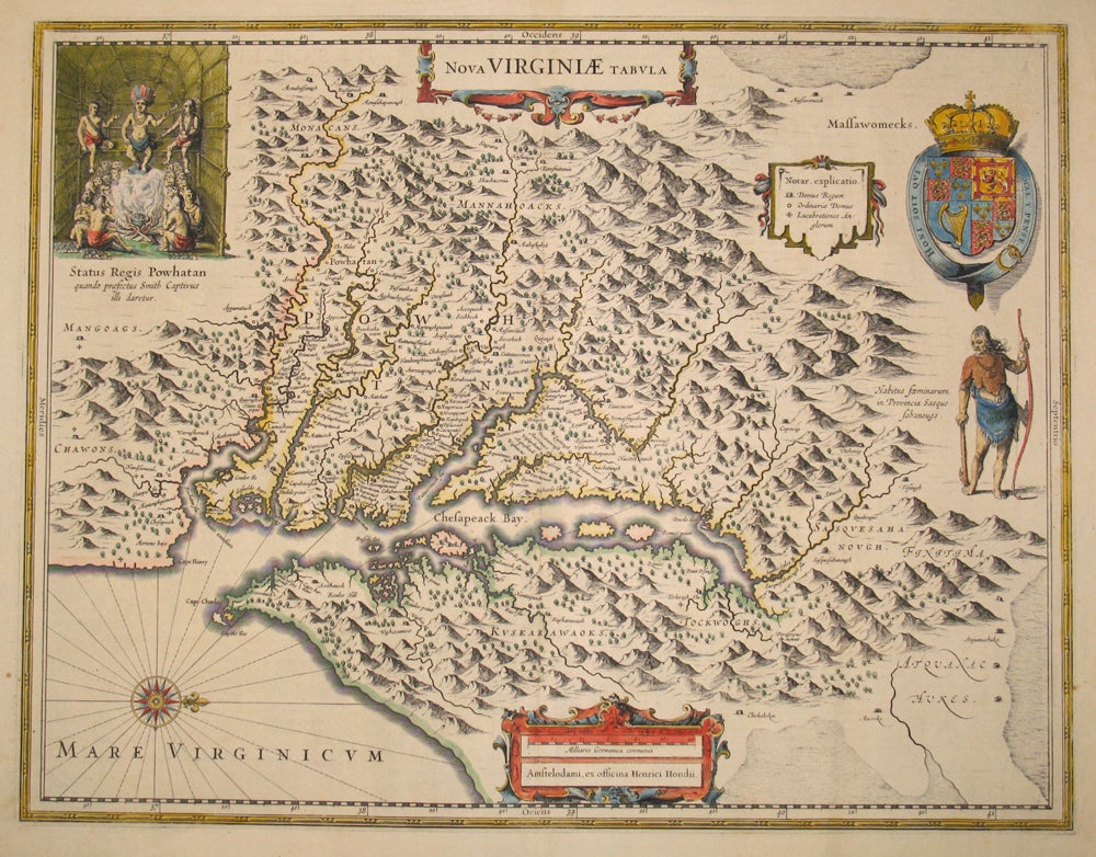
Nova Virginiae Tabula.
Amsterdam: Hondius, 1633-1665. Attractive map of the Chesapeake region, showing Virginia and Maryland, and based on John Smith's famous 1612 map, the most important map of Virginia in the early 1600's & critical in creating interest in settling the area. Jamestown indicated as "Iamestowne". The map has the same inset as Smith's map of the Native American leader Powhatan at the upper left; a coat of arms and Native American figure and cartouche at the bottom. Text on the verso in French. Image size: 19 3/4 x 15'. Paper size: 22 1/4 x 18 3/4". One short closed tear at the lower left, repaired on the verso, otherwise very good. Burden, Mapping of North America #228. Item #15874
Price: $2,750.00