
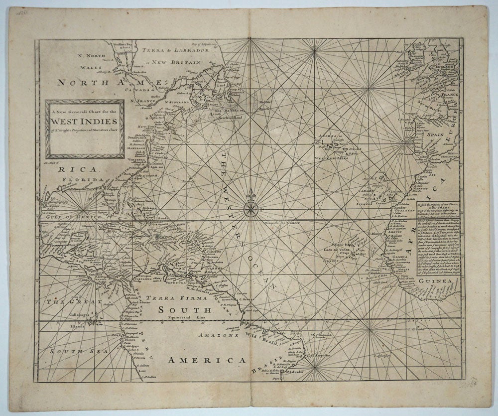
A New Generall Chart for the West Indies of E. Wrights Projection vul. Mercators Chart.
London: ca. 1750. Engraved uncolored chart of the entire Gulf of Mexico, extending from Hudsons Bay in North America, through Central America and to St. Salvador in Brazil, with western Europe (England, France, Spain) and West Africa in the east. First published ca. 1750 in The English Pilot. Using Mercator projection, with a text block at the right margin explaining how "to find the distances of two places in this chart". With compass rose, rhumb lines, and decorative title cartouche. Image size: 22 1/4 x 17 3/4". Paper size: 24 1/2 x 20 5/8". References: Phillips, P.L. (Atlases) 10318-2, 10324-2. Very good. Item #15889
Price: $650.00
See all items in
MAPS