
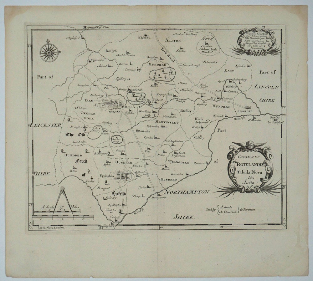
Comitatus Rotelandiae Tabula Nova & Aucta.
1695. Ca. 1695. Uncolored copper engraved map of Rutland, England's smallest county. Originally published in 1684 in James Wright's 'History of Rutland'. With unusual bird's eye view plans of Okeham and Uppingham; also the Priory, Martin's thorp, and the roads through the county. Showing parts of Leicestershire, Lincolnshire and Northamptonshire. Image size: 14 1/4 x 11 1/4". Paper size: 16 5/8 x 15". Very good. Item #15904
Price: $145.00
See all items by Robert Morden