
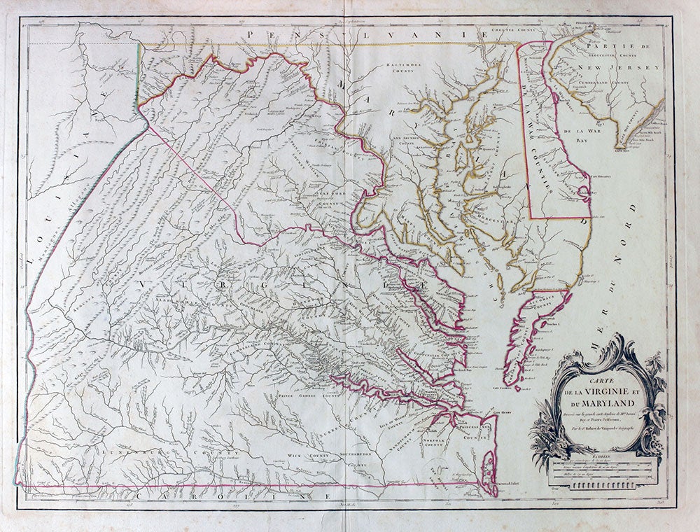
Carte de la Virginie et du Maryland Dressee sur la Grande Carte Angloise de Mrs. Josue Fry et Pierre Jefferson.
ca. 1778. Original outline color detailed map of pre-Revolutionary war Virginia, the earliest map to accurately depict the interior of Virginia. Based on the Fry & Jefferson map of 1751, and published in the Atlas Universel. Below the cartouche to the left appears the name of the engraver of the cartouche, Charles Jacques Groux, who engraved the cartouche on the editions of this map published from 1778 on. The map was reduced from four sheets to one; it includes De La War, the southern end of New Jersey and Philadelphia. With title cartouche and scale at lower right. Title in French; map place names in English. Image size: 25 1/2 x 19". Paper size: 30 1/4 x 22". Faint damp staining at lower and left margins; two ownership stamps on verso (not visible on the map side), otherwise very good. Pedley, M.S. 470/1; Sellers & Van Ee 143. Item #15910
Price: $4,000.00