
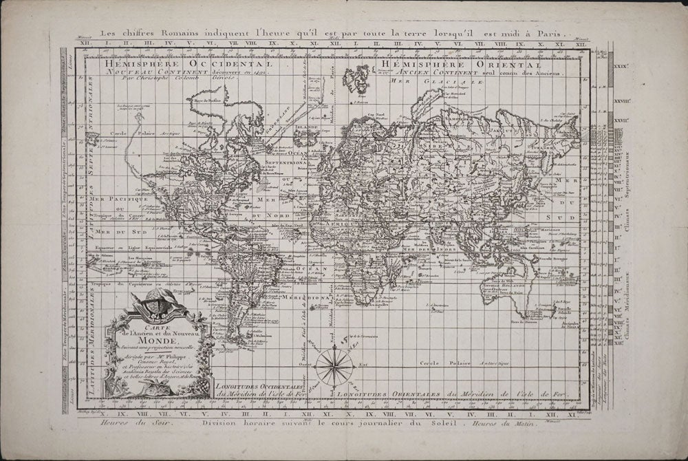
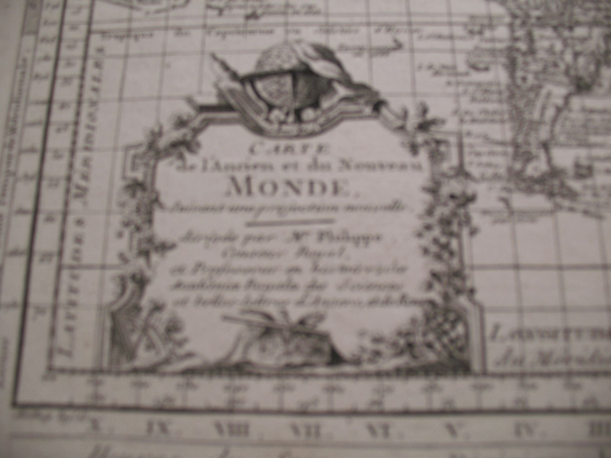
Carte de l'Ancien et du Nouveau Monde, suivant une Projection Nouvelle, dirigee par Mr. Philippe...
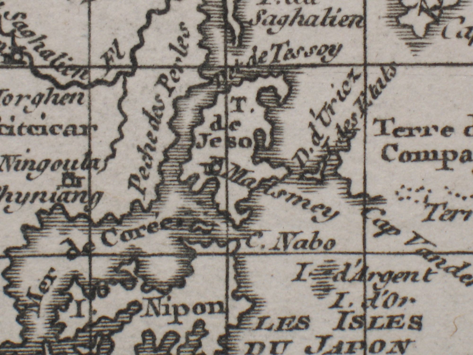
1787. Ca. 1787. Very detailed map of the world on a flattened Mercator projection. With the hypothetical east coast of Australia, showing New Guinea attached to Carpentaria. Despite the fact that the map was published after Captain James Cook's explorations, only Tasman's west coast of New Zealand is shown. With great detail in the oceans, and with recent discoveries noted in the south and north Pacific, Canada and Greenland. The prime meridian runs through Paris; with an elaborate title cartouche, and compass rose. Uncolored, on laid paper. Image size: 16 1/2 x 11 1/2". Paper size: 20 x 13 1/4". Pin hole at center fold, otherwise very good. Item #15918
Price: $750.00