
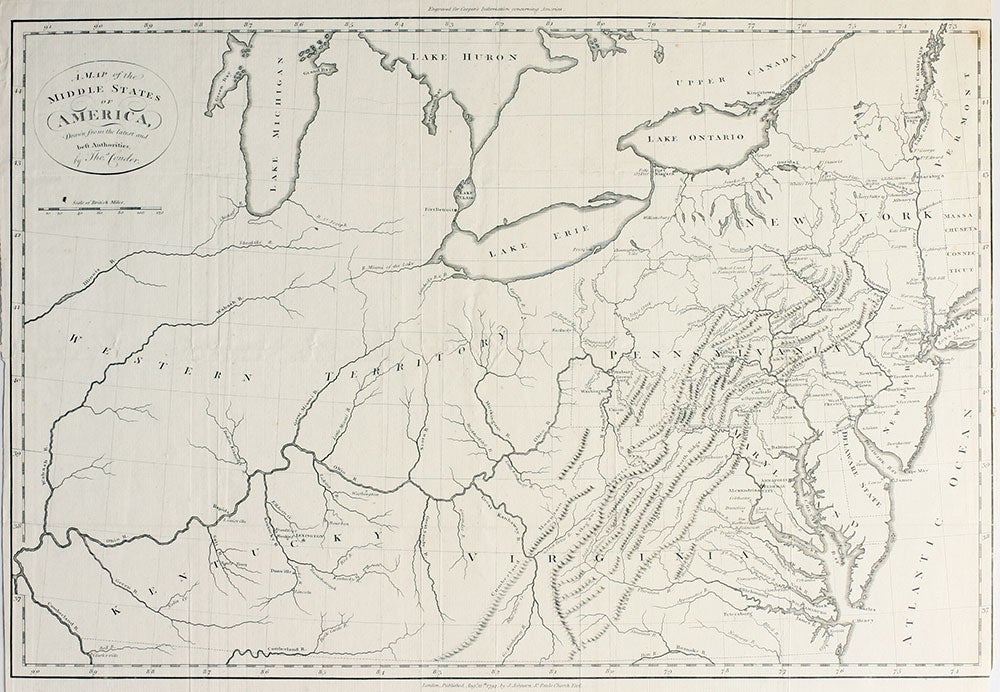
A Map of the Middle States of America, Drawn from the latest and best Authorities . .
London: 1794. Scarce English map of the mid Atlantic states and the 'Western Territory' of the United States, including New York, New Jersey, Pennsylvania, Maryland, Delaware, Virginia and Kentucky (only two years after it became the 15th state to join the United States). Some towns west of the Ohio are indicated, such as Lexington and Louisville in Kentucky; Fort Detroit is shown at the southern end of Lake St. Clair; the Ohio River very clearly delineated. The map is from 'Some Information Respecting America, Collected by Thomas Cooper, Late of Manchester', in which Cooper compiled information for English considering emigrating to the United States. Image size: 18 x 12". Trimmed at right margin, with a very small nick to lower right corner of outer border, small crack on fold below the first 'A" in the word "Pennsylvania" otherwise very good. Item #15952
Price: $500.00