
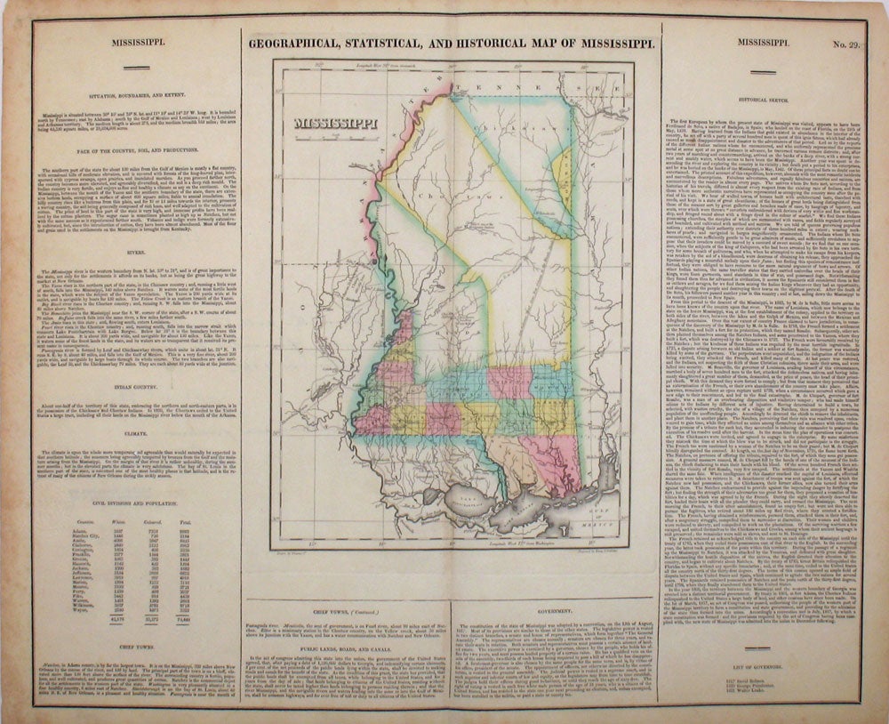
Geographical, Statistical, and Historical Map of Mississippi.
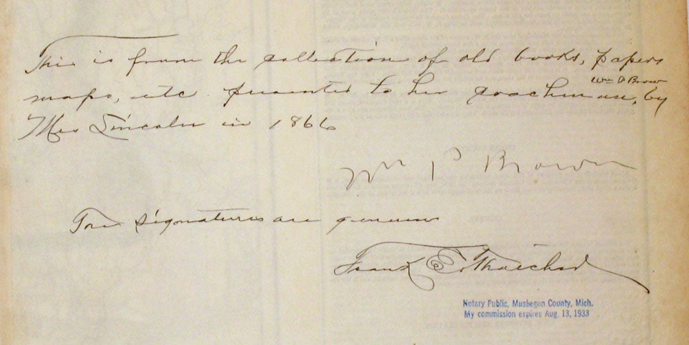
Philadelphia: 1823. Fine original hand colored map of Mississippi from Carey and Lea's 'A Complete Historical, Chronological, and Geographical American Atlas, being a Guide to the History of North and South America, and the West Indies . to the Year 1822', the best atlas of nineteenth century America. With text on two sides and below map, pertaining to topography, climate, lands, towns & rivers, 'Indian Country', public lands, roads & canals, government and history. This map, according to History Detectives (Season 6, Episode 4: Lincoln Forgery) was evidently part of an Abraham Lincoln memorabilia scam in which a forger named Harry Sickles worked with Eugene Field II to pass off items in Field's collection as Lincoln items. Sickles and Field managed to convince William P. Brown, the still living coachman of Abraham Lincoln, that they wanted his signature on the verso of their items. Brown's signature, and the notary's signature are genuine; the text referring to the map being given by Mrs. Lincoln to Brown in 1866 was added by the forger. This is the handwritten note on the verso: "This is from the collection of old books, papers, maps, etc presented to her coachman, Wm. P Brown, by Mrs. Lincoln in 1866. (Signed) Wm P Brown. The signatures are genuine. (Signed) Frank E. Thatcher". There is a blue notary stamp, (Muskegon County, Mich. 1933) and a circular blind stamp. Howes C133; Phillips 1373a; Wheat, Mapping of the Transmississippi West 2:81. Image size: 20 3/4 x 16 1/2" on paper 22 1/4 x 17 1/2" Very good condition. Item #15954
Price: $475.00