
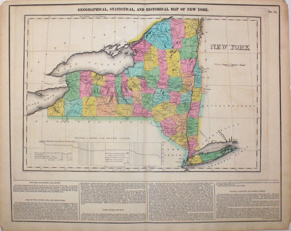
Geographical, Statistical, and Historical Map of New York.
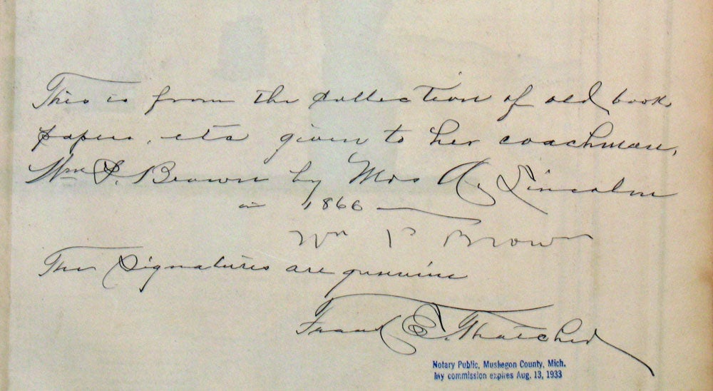
Philadelphia: 1823. Fine original hand colored map of New York from the first edition of Carey and Lea's 'A Complete Historical, Chronological, and Geographical American Atlas, being a Guide to the History of North and South America, and the West Indies to the Year 1822', the best atlas of 19th century America. This map was made during the construction of the Erie Canal, which had such an enormous impact on transportation, commerce and the role of New York City as the major US port; it is named here the Grand Canal. With a table at the base of the map titled "Profile of Levels of the Grand Canal", showing the change in levels of the Erie Canal from Lake Erie to the Hudson River. With text below map and at both sides, pertaining to topography, climate, lands, towns, roads and canals, education, government and history. This particular copy of the map has an interesting Lincoln forgery connection. According to History Detectives (Season 6, Episode 4: Lincoln Forgery) was evidently part of an Abraham Lincoln memorabilia scam in which a forger named Harry Sickles worked with Eugene Field II to pass off items in Field's collection as Lincoln items. Sickles and Field managed to convince William P. Brown, the still-living coachman of Abraham Lincoln, that they wanted his signature on the verso of their items. Brown's signature, and the notary's signature are genuine; the text referring to the map being given by Mrs. Lincoln to Brown in 1866 was added by the forger. This is the handwritten note on the verso: "This is from the collection of old books, papers, maps, etc presented to her coachman, Wm. P Brown, by Mrs. Lincoln in 1866. (Signed) Wm P Brown. The signatures are genuine. (Signed) Frank E. Thatcher". There is a blue notary stamp, (Muskegon County, Mich. 1933) and a circular blind stamp. Howes C133. Image size: 20 3/4 x 16 1/2" on paper 22 1/4 x 17 1/2" Very good condition. Item #15972
Price: $300.00