
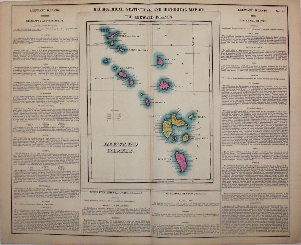
Geographical, Statistical, and Historical Map of the Leeward Islands.
Philadelphia: 1823. Fine original hand colored map of the Leeward Islands (the northern islands of the Lesser Antilles chain, east of Puerto Rico and running southward to Dominica; they are named 'Leeward' because the prevailing winds blow from the east), from the first edition of Carey and Lea's 'A Complete Historical, Chronological, and Geographical American Atlas, being a Guide to the History of North and South America, and the West Indies . to the Year 1822', the best atlas of nineteenth century America. Extending from Anguilla in the north to Dominica in the south. With many towns and ports named, especially on Guadaloupe (Columbus named the island 'Santa María de Guadalupe' after the Virgin Mary) . A very vibrant, strong impression. With text below map and at both sides, pertaining to the geography and history of each island. Howe's C133. Image size: 20 3/4 x 16 1/2" on paper 22 1/4 x 17 1/2" Very good condition. Item #15983
Price: $300.00