
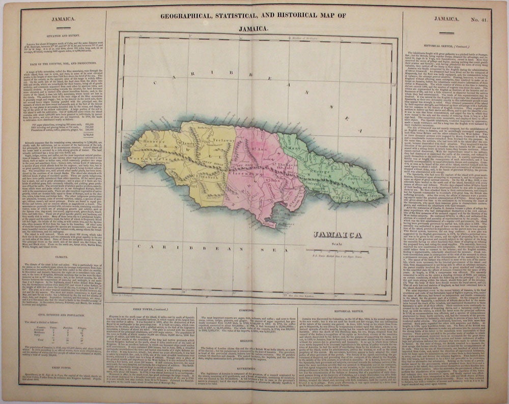
Geographical, Statistical, and Historical Map of Jamaica.
Philadelphia: 1823. Fine original engraved map of the island of Jamaica, from the first edition of Carey and Lea's 'A Complete Historical, Chronological, and Geographical American Atlas, being a Guide to the History of North and South America, and the West Indies . to the Year 1822', the best atlas of nineteenth century America. With Jamaican counties and parishes, and towns and harbors, including Kingston, Port Royal and Montego Bay. Under the text heading 'Civil Divisions and Population' is the following information on the number of slaves: "In 1812, there were 319,912 slaves, and the number of whites and free people of colour was estimated at 40,000". A very vibrant, strong impression. Howe's C133. Image size: 20 3/4 x 16 1/2" on paper 22 1/4 x 17 1/2" Very good condition. Item #15986
Price: $200.00