
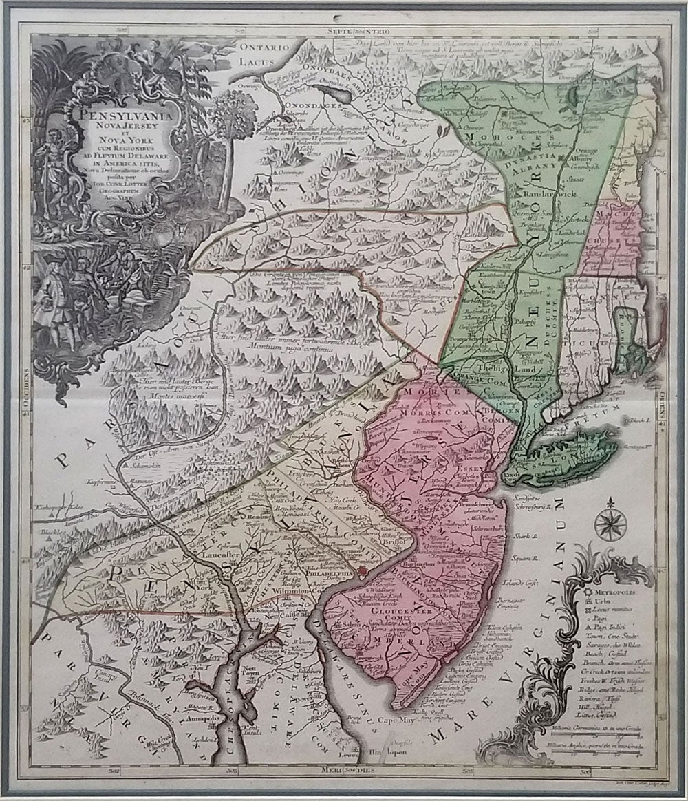
Pensylvania Nova Jersey et Nova York cum Regionibus ad Fluvium Delaware in America Sitis.
[1757]. An important pre-Revolutionary War original hand colored engraved map extending from New England to the Delaware and Chesapeake. From the Atlas Novus. Highly distorted northeast New England, with Cape Cod shown as part of Connecticut, New York divided into three sections & including parts of Massachusetts and Vermont. Long Island is shown connected to West Chester. With colonial settlements and Native American villages shown; title cartouche illustrated with William Penn and Native Americans and compass rose. Size: 19 1/2 x 22 1/2", framed 28 x 31" Item #16195
Price: $3,400.00
See all items in
MAPS
See all items by Tobias Lotter