
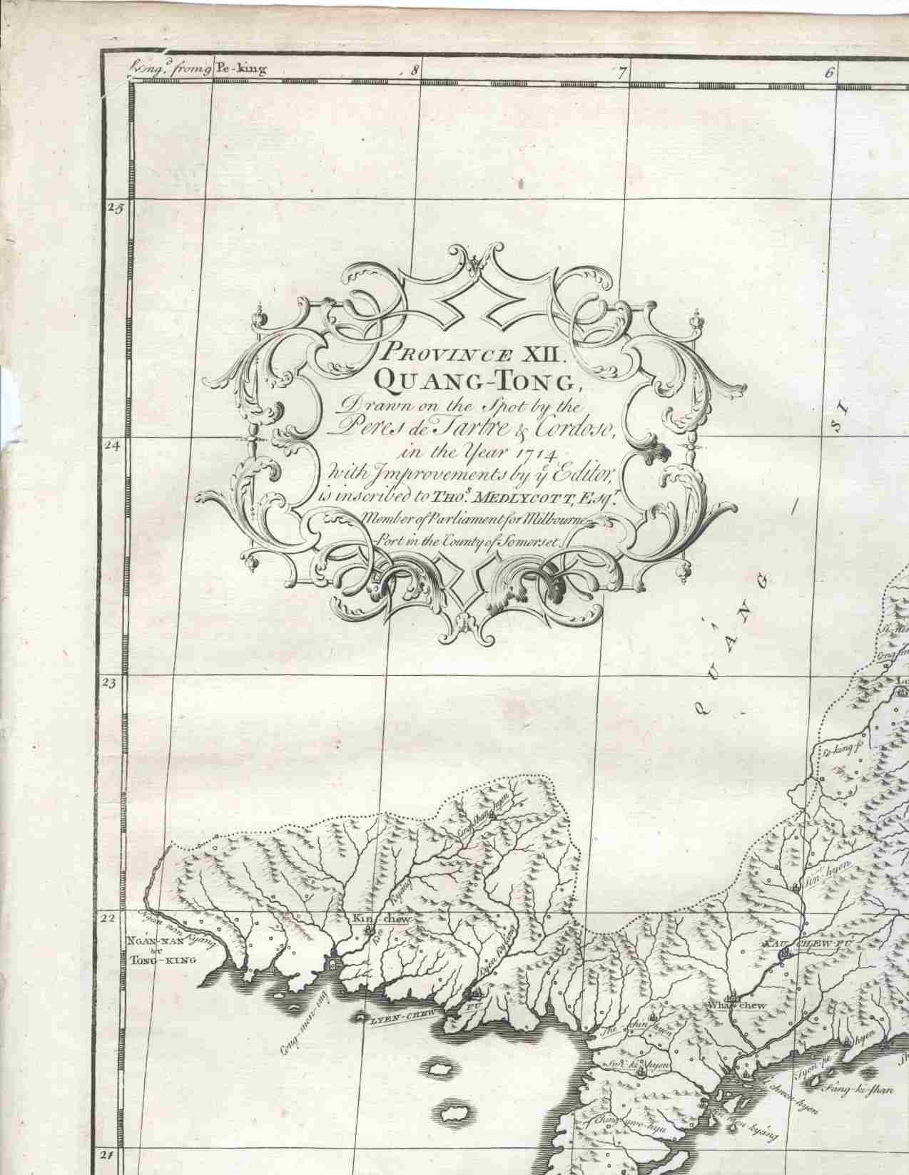
Province XII. Quang-Tong, drawn on the Spot by the Peres de Tartre & Cordoso, in the Year 1714 with Improvements by the Editor...
London: Edward Cave, at St. John's Gate, 1738. A map of the China coast from Behai to Shantou, centering on the Pearl River, Canton, Macau & the islands of Hong Kong. Copper engraved map, 20 3/4 x 16 1/2" with sml margins. The map is from the Edward Cave folio edition of this important encyclopedic work on Chinese culture, history and society, "A Description of the Empire of China and Chinese-Tartary, Together with the Kingdoms of Korea, and Tibet" by a French Jesuit who specialized in China. Du Halde's work inspired great interest in China among Europeans, and was a ground breaking work in geography. The Du Halde book is referred to in Cordier BS 50; Löwendahl 409; Lust 15. Very good condition. Item #16233
Price: $1,250.00