
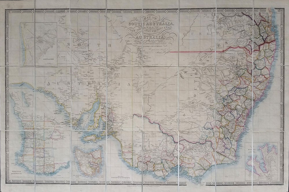
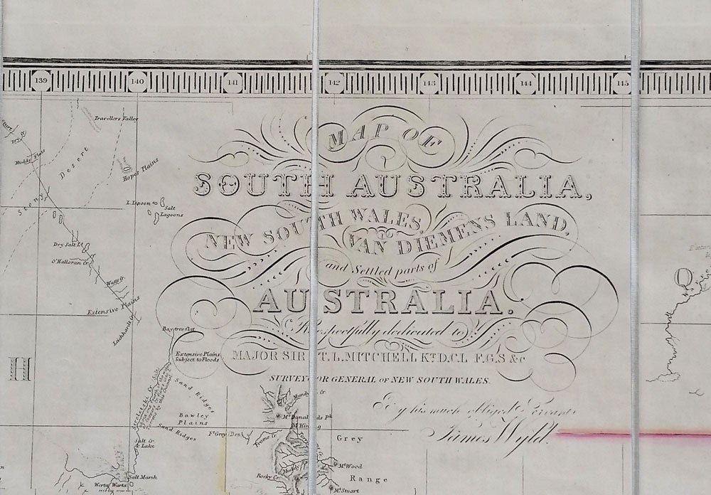
South Australia. Map of South Australia, New South Wales, Van Diemens Land and Settled Parts of Australia, with plans of the City of Sydney, and of the town of Adelaide.
Charing Cross East, London: James Wyld, Ca. 1854. Maps. The map extends from Wide Bay in the north to Wilsons Promontory in the south. Insets of Adelaide, Western Australia, Van Dieman's Land, and Sydney. The title on the map is: Map of South Australia, New South Wales, Van Diemens Land and Settled Parts of Australia. Dedicated to Major Sir T. L. Mitchell ... surveyor of New South Wales. The map shows both Australia Felix and Victoria and includes Gold Deposits and Railroads; the northern border of New South Wales shown. Folded, dissected and mounted on linen, fresh and clean. With the original dark green slipcase with white and gray label with black decorative floral border; very good. Slipcase rubbed at corners, marked on verso; later spine label partially torn away. Tooley 1420 without publication date. Trove has 5 entries from 1838 until 1851 (41236330), but not this later copy. Map in original outline color, 38 1/2 x 26 1/4". Very good. Item #16611
Price: $1,250.00