
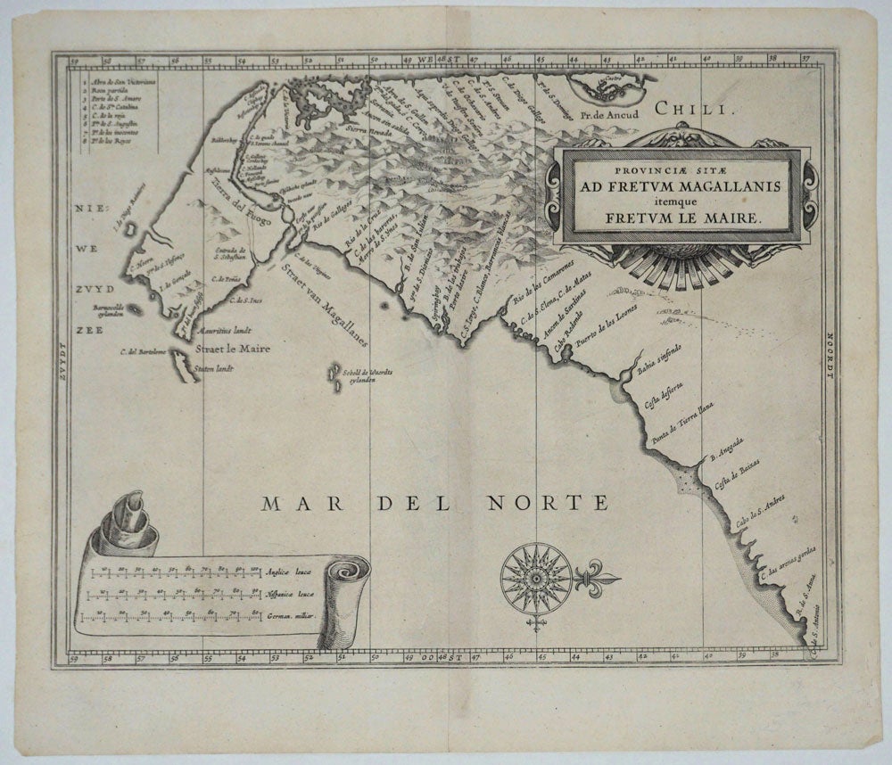
Provinciae Sitae Ad Fretum Magallanis itemque Fretum le Maire.
Amsterdam: ca. 1630. Important map concerning Dutch trade routes to the East, showing the Straits of Magellan and "Tierra del Fuogo" and the southern end of South America, made for Dutch geographer Johannes De Laet's important work on the new world, 'Nieuwe Wereldt ofte Beschrijvinghe van West-Indien'. Knowledge of this area was of great importance to the Dutch West India Company, for whom Gerritsz was official map maker, as the company challenged the Spanish and Portuguese monopoly on trade routes to East and the profitable spice trade. Gerritsz used the latest information on the area, based on the recent discoveries of Isaac Le Maire and Willem Schouten, Dutch explorers who passed the Straits of Magellan in 1615 searching for a shorter passage to the Pacific, and discovered the "Straet le Maire". Image size: 14 x 11". Paper size: 15 1/4 x 13 1/4" Very good condition. Item #17959
Price: $750.00