
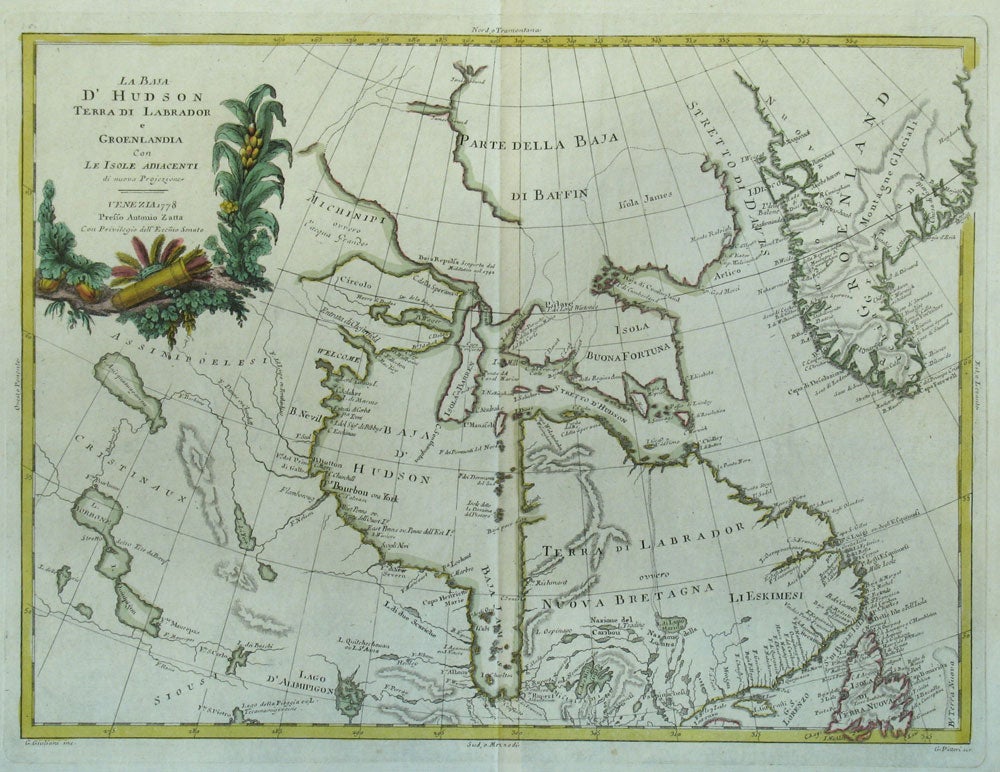
La Baja d'Hudson Terra di Labrador e Groenlandia con le Isole Adiacenti di nuova Projezione.
Venezia: 1778. First edition. Rare map of Arctic North America including Canada, Greenland, the Northwest conveniently hidden by the cartouche, due to it's uncertain mapping. Geographical locations marked are James & Jones Sound; Nuova Bretagna, Terra di Labrador, Baja d'Hudson, Fort Bourbon or York, Lago d'Alaimpigon, Isola Buona Fortuna, Stretto d'Hudson. Areas are sometimes marked for the peoples that inhabit it for example "Li Eskimesi" at New Breton; 'Assinipoleesi' and 'Cristinaux' to the west of Hudson Bay; 'Siousi' to the south, 'Michinipi ouvero l'Acqua Grande'. Copper engraved, original outline color, watermarked paper. 15 3/4 x 11 3/4" plus platemark and full margins. Attractive map, as are all of Zatta's cartographic works, with the cartouche illustrating a Native American feather headdress & quiver of arrows, with corn, squash and beans. Item #18039
Price: $750.00