
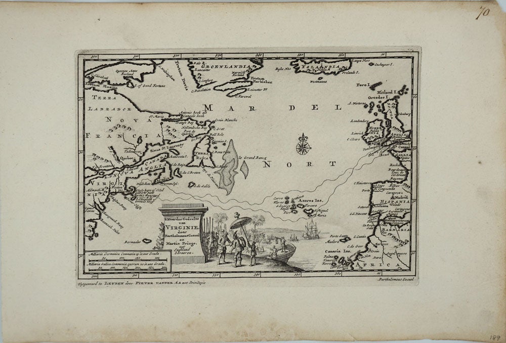
't Noorder Gedeelte van Virginie door Bartholomeus Gosnol en Martin Pringe uyt Engeland Bevaaren, map.
Leiden: 1706. Copper engraved map showing the route from England to Cape Cod, passing the Azores, taken by "Bartholomeus Gosnol" and "Martin Pringe", relatively unrecognized English explorers who lead the first recorded European expedition to Cape Cod, predating William Bradford and the Pilgrims.
Bartholomew Gosnold (1572 - 1607) was an English explorer, instrumental in the formation of the Virginia Company and considered by Preservation Virginia to be the "prime mover of the colonization of Virginia". Gosnold pioneered the route west from the Azores to New England (then called Virginia); he named Cape Cod in 1602, discovered Martha's Vineyard (named after his daughter) and established a small settlement on Cuttyhunk Island (one of the Elizabeth Islands). Martin Pring (1580 - 1626) was an English explorer who arrived on Cape Cod (possibly Edgartown) in 1603, just after Gosnold.
9 1/4 x 6 1/4"; paper size 13 1/2 x 9". Bright clean copper impression on clean paper, wide margins with period manuscript number 70 written in the top right corner of the margin. Reference Phillips, P.L. (Atlases) 5482, 69. Very good condition. Item #18533
Sold