
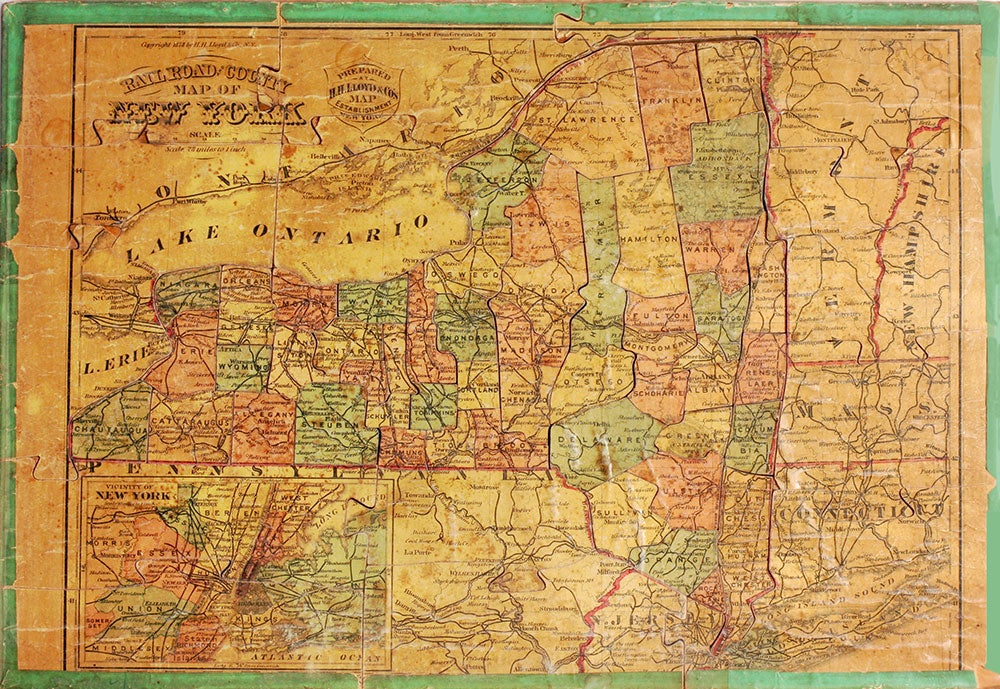
Railroad and County Map of New York.
New York: H.H. Lloyd & Co's Map Establishment, 1878. A jigsaw map puzzle cut along county lines, centered on New York state, but also showing Vermont, much of New Hampshire and Western Massachusetts, Connecticut, north eastern Pennsylvania and northern New Jersey with an inset of "Vicinity of New York. Chromolithograph applied to wood. Scale 28 miles to 1 inch. 11 x 15". A bit browned with a couple of small gaps, slightly uneven surface, most of the green border intact. Good + overall. Very unusual. Not in Rumsey's collection. Item #18534
Price: $275.00
See all items by H. H. Lloyd, Co