
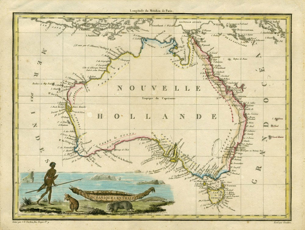
Oceanique Centrale.
Paris: 1809. The continent of Australia dominates this map. It is cartographically important as an early depiction of the Peron/Freycinet voyage that named many portions of the South Australian coast. Some of Flinder's coastal names are included. West of the Blue Mtns, a large lake is dotted-in "according to the natives". Handsome engraving lower left corner of an aboriginal walking with a shield, his canoe acting as a banner containing the title "Oceanique Centrale", nearby a platypus, wombat & numbat (with later hand color). Copper engraving, 12 x 8 3/4", original outline hand-color outlining the coast and border. Slightly toned outside the platemark, very good overall. Tooley plate 67 & 151, p. 112 #843. Item #18852
Price: $750.00