
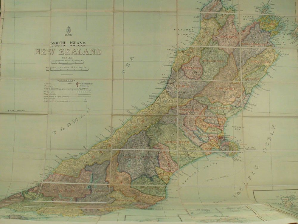
Large maps of New Zealand, North Island (Surveyor W. T. Neill) & South Island, by Surveyor General E. H. Wilmot.
Wellington, New Zealand: Ca. 1920; 1927. Two large maps of New Zealand's North and South Islands, mounted on linen. The map of the South Island in full color, by the surveyor E. H. Wilmot, for whom Wilmot Pass, the main divide in the South Island is named. The map shows Mt. Wilmot and Wilmot Pass. Marcus F. Marks, Government Printer Wellington, and and Draughtsman M. Crompton Smith. With 6 insets at the lower right, showing the Auckland Islands, Chatham Islands, Campbell Islands, Antipodes Islands, Snares Islands and Bounty Islands. 44 x 53".
The map of the North Island printed in black and green, by W. T. Neill, Surveyor General 1927. With an inset of the Cook Islands at the upper right corner. With the left hand border slightly trimmed. 36 x 60" Fine. Item #19277
Price: $325.00