
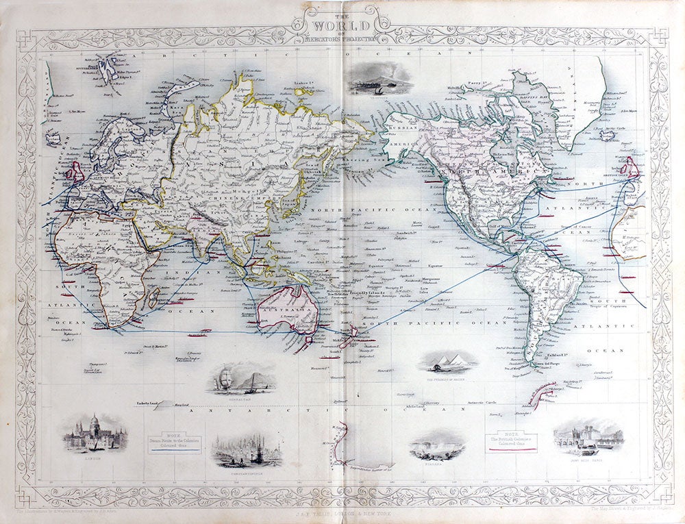
The World on Mercator's Projection, antique map with vignette views.
London: John Tallis & Co., 1854. Maps. Steel engraved map from the famous Victorian publisher John Tallis, well-known for the attractive vignette views surrounding the maps, which illustrate the peoples & customs of that region. Attractive decorative border around edge, vignette views of Vesuvius, London, Gibraltar, Constantinople, The Pyramids of Gizeh, Niagara and Pont Neuf, Paris & the British Colonie's colored in red, with the "Steam Route to the Colonies" colored in blue. Australia is at the center, colored in red, with Antarctic (South Victoria) designated. Three sightings of Antarctica are included: the Palmer Peninsula, South Victoria and Enderby Land, from the Ross Expedition. Period outline color, a little close on the left page margin, original center fold, very good condition overall. 10 x 13 1/2" plus margins. Item #19788
Price: $375.00