
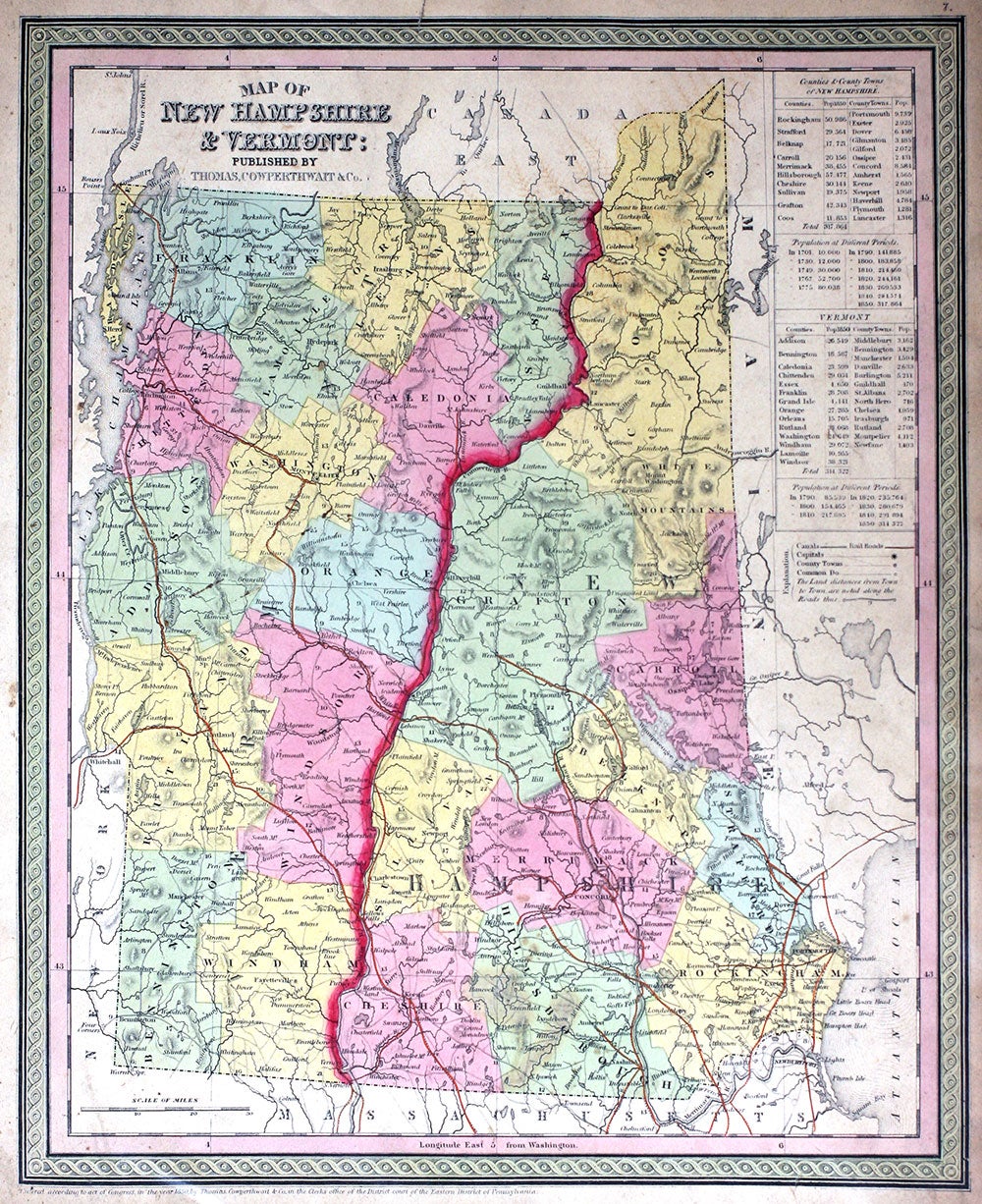
Map of New Hampshire and Vermont.
Philadelphia: Thomas, Cowperthwait & Co., 1850. Maps. Map of New Hampshire and Vermont, with counties marked, travel information (distances, railroads, steamboat routes in states served by them, population, canals, capitals, county towns, etc.) Approx. 12 1/2 x15 1/2". From the "New Universal Atlas containing Maps of the various Empires, Kingdoms, States and Republics of the World with a special map of each of the United States Plans of Cities & c." Chromolithographs with printed color. A little tanned, edges a little ruffled, o/w minor faults generally in the margins. Very good overall. Item #20052
Price: $125.00
See all items in
MAPS
See all items by Cowperthwait Thomas, Co