
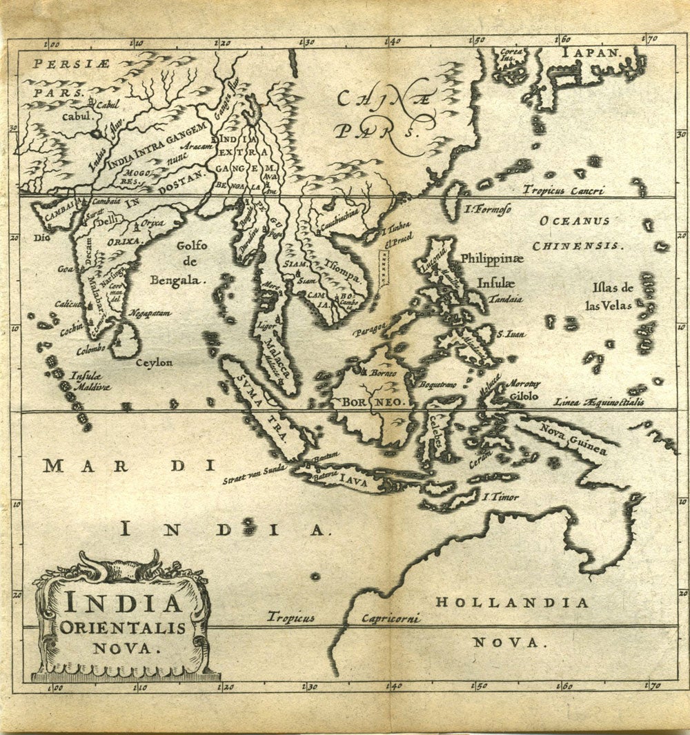
India Orientalis Nova. Minature map of South East Asia with Australia.
Amsterdam: Elzevir, 1659. Charming miniature map showing the northern two-thirds of Australia pre- Cook, but showing discoveries by Abel Tasman in 1642. The fame of the Elzevir editions rests in their small editions and elegance of design, clearness and regularity of type- this map is from Elzevir atlas published in about 1659. The map shows Australia and South East Asia. Relief is show pictorially. From "Philippi Cluverii introductionis in universam geographiam tam veterem quam novam libri vi Tabulis aeneis illustrari. Accessit P. Bertii breviarium orbis terrarum /[by] P. Cluver." Scale [ca. 1:70 000 000] . China (Chinae Pars); Southern part of Japan; Korea (Corea Ins.); the Indian Subcontinent (India Intra Gangem, Indostan, Orika); Thailand (Siam); Indonesia (Borneo, Sumatra, Java, Celebes, Timor); New Guinea (Nova Guinea); Philippines (Philippinae Insulae); Malaysia (Malacca); Cambodia; Vietnam (Tsiompa); off the China coast (I. Tinhoa & El Pracel, I. Formosa). 12mo. 11.5x12 cm. Not in Tooley. The National Library of Australia holds it as listing MAP RM 1167. Reference: Phillips, 4261. Trimmed close on 2 sides but overall very good condition. Item #20107
Sold