
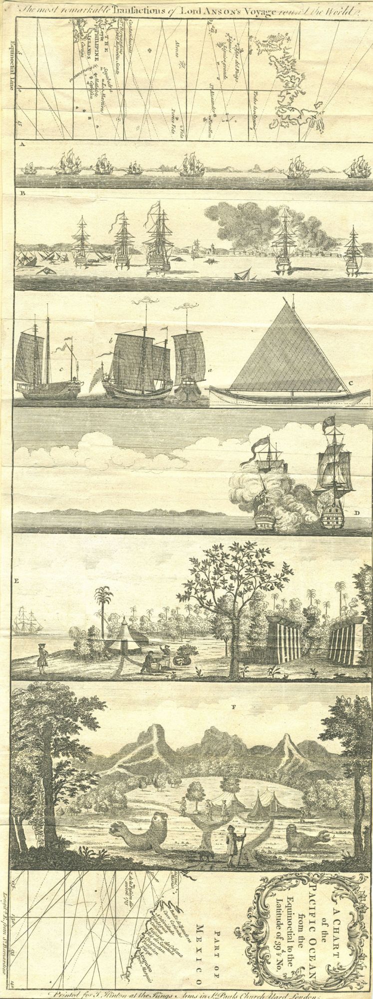
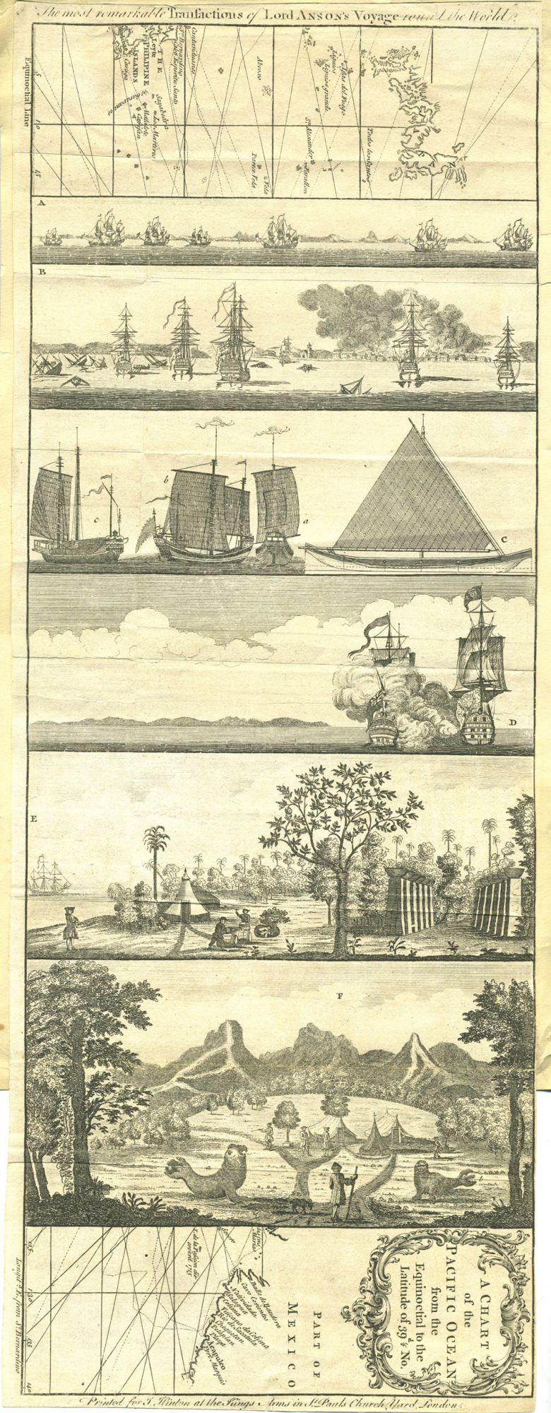

The Most remarkable Transactions of Lord Anson's Voyage round the World. A Chart of the Pacific Ocean... (Map with picture strip).
London: Printed for J. Hinton at the Kings Arms in St. Pauls Church Yard, 1748. First printing. Maps. A copper engraved "picture strip" of Anson's chart of the Pacific embellished with views depicting the major events of his voyage around the world. The map has the Philippines and Japan on the left margin of the map and of the west coast of North America on the right. The engraved views sandwiched in between are lettered A through F:
A: View of Part of the Northeast Side of Terra del Fuego and the entrance of Straits Le Maire;
B: Burning of the town Payta on the coast of Santa Fee in the South Sea;
C: Chinese Vessels;
D: A View of Cape Espiritu Santo on Samal and one of the Philippine Islands ... Majesty's ship Centurion engaged and took the Spanish Galleon called Nostra Seignora De Cavadonga;
E: A View of the Watering Place at Tenian; and
F, which is a compilation view, titled "A View of the Commodore's Tent at the Island of Juan Fernandes" has been modified with the addition of two sea lions in the foreground. Anson is depicted with his back to the viewer, looking towards his tents, and flanked by a male and a female sea lion rather incongruously reclining in the wooded landscape.
Anson's voyage appears to have been the most popular book of maritime adventure of the eighteenth century. (Hill p. 318.). It was first published in 1748, and continues to be re-printed to this day. This map was issued in the Universal Magazine in 1748, reflecting the contemporary interest in his Voyage. It is referenced as UNIV-13 in David Jolly's "Maps in British Periodicals, Part I," Brookline, MA 1990, p. 188. Mr. Jolly remarks that the maps in the Universal Magazine are among the "best executed and most attractive of the magazine maps... many (with) decorative cartouches."
Interestingly, the longitude is measured not from Greenwich, Paris or Philadelphia, but from St. Bernardino in the Philippines, with the notation outside the bottom right border "Longitd. E. from St. Bernardino".
Approximately 8 x 20 3/4". Copper engraving, old folds, now flat, trimmed close, tipped onto a larger sheet of paper. Very good condition overall. Very good condition. Item #20135
Sold