
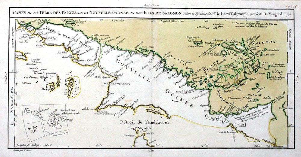
Carte de la Terre des Papous, de la Nouvelle Guinee, et des Isles de Salomon selon le systeme de M. le Chevr Dalrymple par le Sr. De Vaugondy 1774.
Paris: Chez Saillant & Nyon, 1774. Map of Papua New Guinea & the Solomon Islands with interesting original hand color. The map extends through the tip of the Cape York, down about as far as the 12th degree of latitude, and including Isle de Wallis and Isle d' York.
The hand coloring is unusual. New Guinea is left white, while the sea and islands to the north of it are washed tan, and the sea to the south is washed yellow. From 'Voyages dans la mer du Sud, par les Espagnols et les Hollandois, ouvrage traduit de l'Anglois de M. Dalrymple, par M. de Freville' (Paris: Chez Saillant & Nyon ..., 1774). In lower left margin: Grave par E. Dussy and with an inset showing northeast New Guinea, labeled "De Bry 1596". At the top of the map, at the right, above neat line: No. 125 in a contemporary hand. Copper engraving, original hand color, very good condition. 17 x 11 1/4", Libraries Australia ID 13070161. OCLC: 222056789 records one copy at the State Library of Queensland. The State Library of New South Wales records a copy, Bib Util 13070161. Very good condition. Item #20144
Price: $750.00