
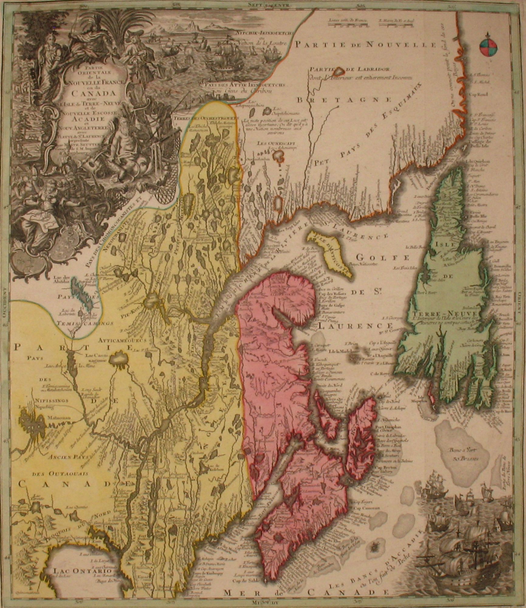
Partie Orientale de la Nouvelle France ou du Canada avec l'Isle de Terre-Neuve et de Nouvelle Escosse Acadie et Nouv. Angleterre avec Fleuve de St. Laurence represente par Math. Seutter geogr. de S.M. Imper.
Augsburg: 1750-1757. Maps. A map with an unusual projection of Maritime Canada and Newfoundland including Nova Scotia, Labrador, Maine. The vertical projection shows the St. Lawrence River running nearly north-south. Detailed, especially along the coastlines and rivers with many locations noted, both European and Indian, including Casco Bay (Baye de Casco), the Penobscot River, Wells, and Cape Elizabeth. At top left is a large decorative cartouche featuring allegorical figures, Indian chiefs from several tribes, explorers, mapmakers, a fleet of ships, fishermen and wildlife. Copper engraving with original hand coloring. Impression mark 19.75"x23" with small margins. Very good condition. Item #20216
Sold