
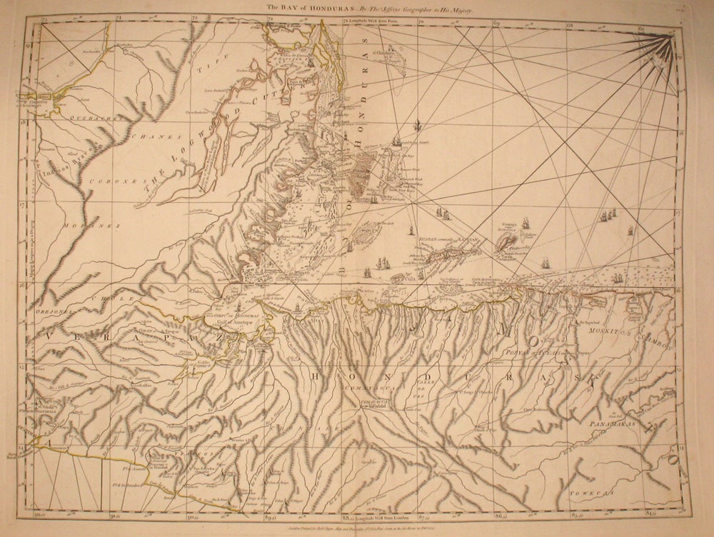
The Bay of Honduras. By Thos. Jefferys Geographer to His Majesty.
London: Robert Sayer, 1775. First edition. Maps. From an early edition of Jefferys' West India Atlas, this is a chart of the coastline from Salamanca de Bacalar to Brewer's Lagoon and the Moskito Coast, centered on the Gulf of Honduras and the Rio Balize. Extends to the Port of Guatimala and La Trinidad on the Pacific Coast, showing numerous volcanoes in the region. The coastline is very detailed, with shoals, islands, soundings and sailing directions and sail ships are used to illustrate navigable routes. Just below Hanover Bay the map indicates "The Logwood Cutters" most likely referring to the lumber industry for Honduran mahogany and rosewood. Many names in both English & Spanish, especially in the regions along the Moskito Coast, where British settlements existed. Sellers & Van Ee #2131. Outline in color, 2 minor tears in margin not affecting map, 24.5x19.5" Very good condition. Item #20220
Sold