
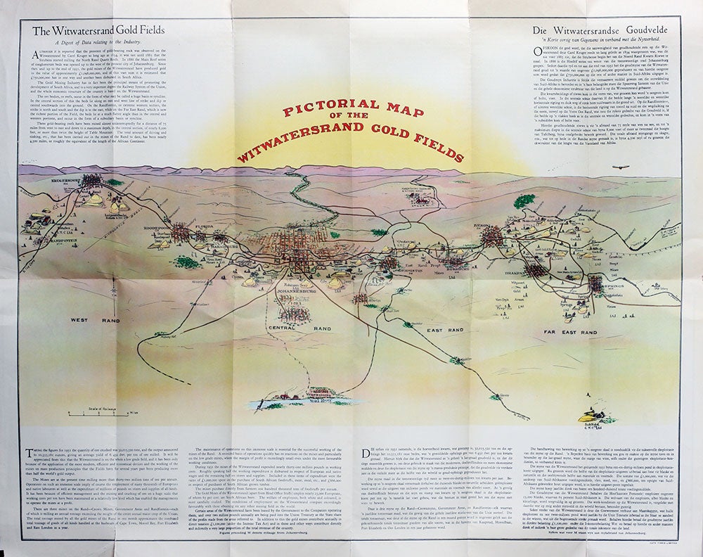
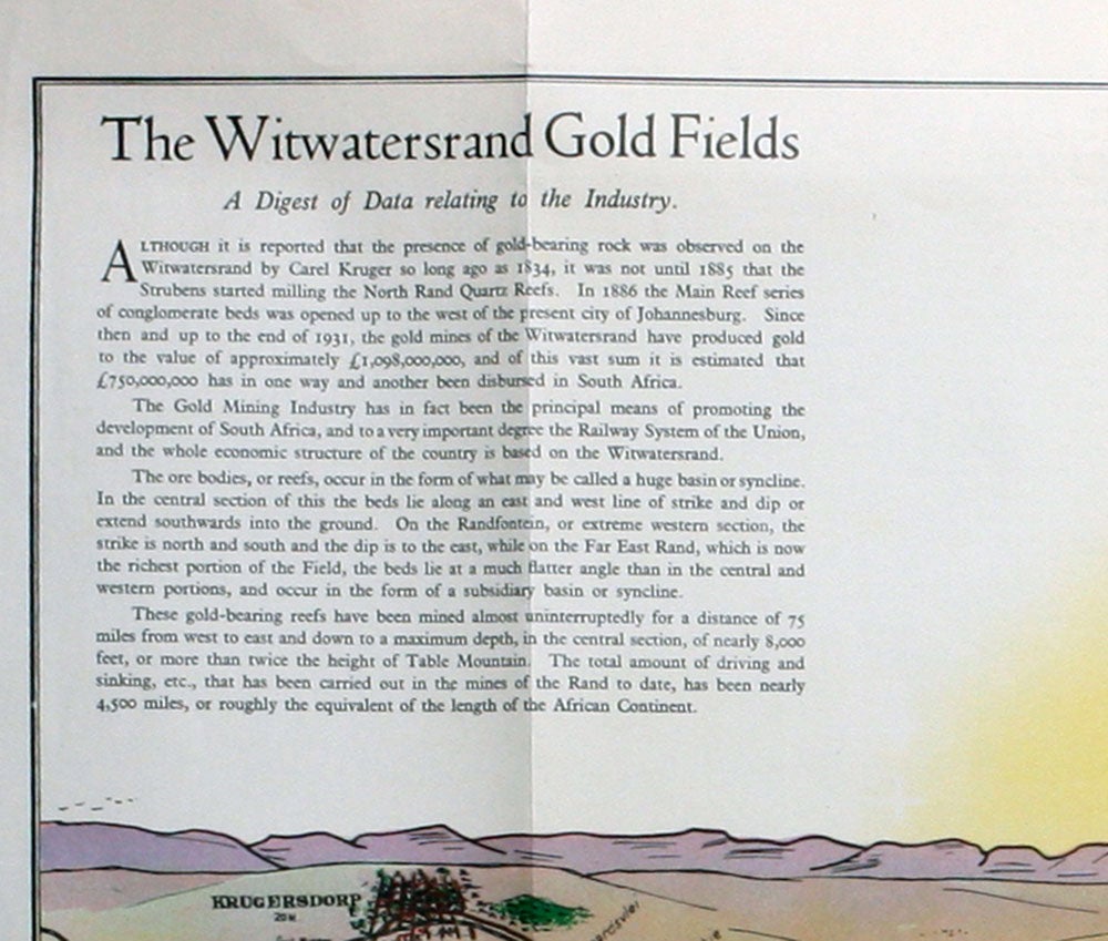
Pictorial map of the Witwatersrand gold fields - Geïllustreerde kaart van die Witwatersrandse goud-velde.
Johannesburg: Gold Producer's Committee, Transval Chamber of Mines, 1932. A pictorial map of the gold fields, issued March 1932. It shows from Krugersdorp in the West Rand to east of Springs, Far East Rand, in the east. 51 x 66 cm., folded to 28 x 12 cm. OCLC: 54655131 cites only 2 copies, at Yale and the Universiteit Utrecht. The artist is not stated. Some short closed splits on folds, some extending slightly into the text beneath the map. Very good overall. Item #20329
Sold
See all items in
MAPS
See all items by Mining, South Africa