
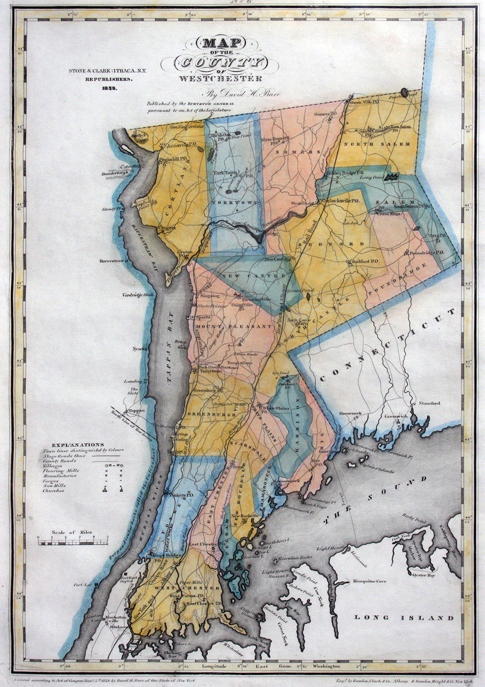
Map of the County of Westchester.
Ithaca, New York: Stone & Clark, Ithaca NY Republishers, 1839 (1840). This attractive map of Westchester is from Burr's rare "Atlas of State of New York", the second county atlas printed in America and "a landmark document that constitutes one of the most precise cartographic records of the State... The whole state, the major cities, each and every county is depicted in a uniform style and scale, with accompanying standardized statistical information and narrative. The state is given shape and form and substance in the atlas. All the counties are now joined together, a civil union is complete, all the land is subdivided, the marks of progress are recorded and celebrated. " (John Rennie Short, Representing the Republic: Mapping the United States 1600-1900, pp. 85-88). "
Towns & districts include Eastchester, New Rochelle, Mamaroneck, Rye, Scarsdale, White Plains, Hastings, Tarrytown, Irving's Landing, Sing Sing, Bedford, Pound Ridge, North & South Salem, Somers, Yorktown, Shrub Oak, Peekskill, Crugers, General Van Cortland, Verplanck's Point, Annsville.
Entered according to Act of Congress Jan 5, 1829 by David H. Burr or the State of New York (lower left); Engraved by Rawdon, Clark & Co. Albany & Rawdon, Wright & Co New York. (lower right). Copper engraved map with original wash color, printed slightly crooked on the sheet, lower left corner with an expertly repaired tear in the margin, touching the impression mark. Printed image 13.25 w x 18" tall; impression mark 14 x 19.25"; paper size 17.25 x 21.5" Very good overall. Item #20491
Sold