
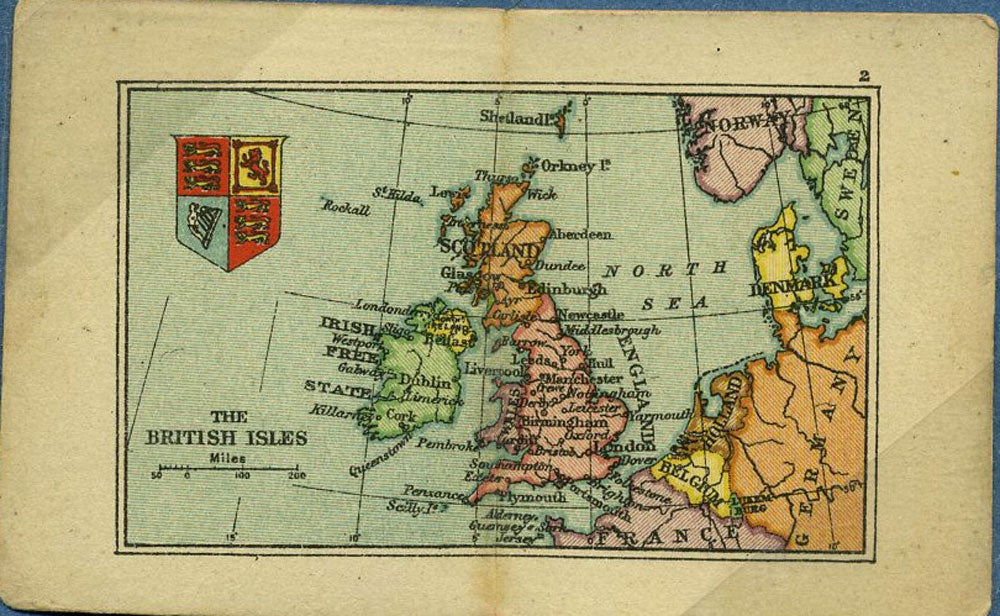
British Isles Map from the Smallest Atlas Ever Published.
London: Edward Stanford, 1928. Map of the British Isles - part of the smallest Atlas ever published, reproduced from the original made for Her Majesty Queen Mary's Doll House. Queen Mary's doll house was built by leading British architect Sir Edwin Lutyens between 1921 and 1924. Printed color map with center fold, 6.5 x 4.2 cm., slt. dusty at center fold, vgc. Very good condition. Item #20534
Price: $45.00
See all items by Edward Stanford