
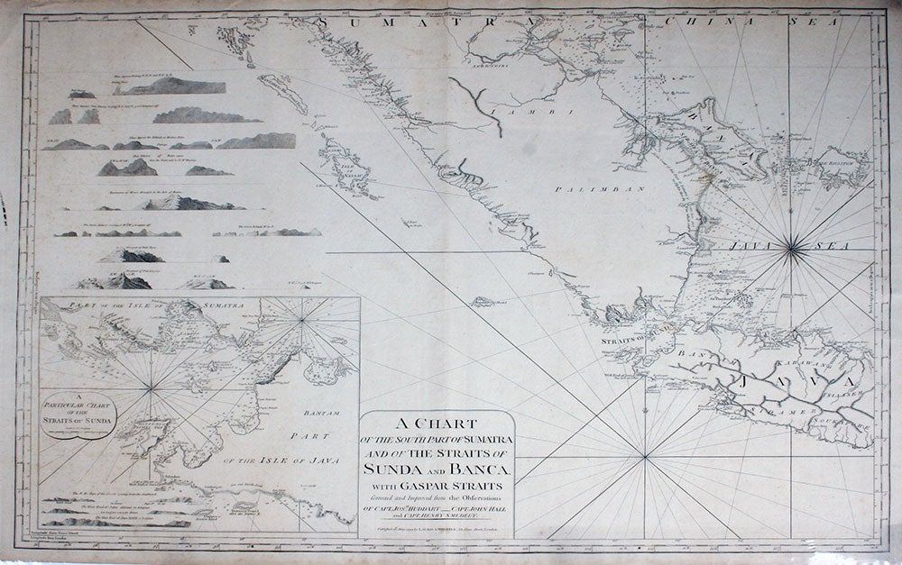
A Chart of the South Part of Sumatra and of the Straits of Sunda and Banca. With Gaspar Straits. Corrected and Improved from the Observations of Capt. Josh. Huddart, Capt. John Hall and Capt. Henry Smedley.
London: Laurie and Whittle, 1794. Maps. Scarce sea atlas by cartographers Laurie and Whittle, of southern Sumatra (cut off at the equator), and western Java. Batavia, the former official name of present day Jakarta, is labeled, inset of "A Particular Chart of the Straits of Sunda". Copper engraving,
Impression 33 1/2" wide x 25 1/4", black on cream background with latitude and longitudinal marks around perimeter, coastal profiles of Padang, Pulo Pesang, Broken Point, Pulo Tellores, Mount Monopin, Seven Islands, Pulo Taya, Pulo Linging. Some faint fox spotting lower left, otherwise clean, bright, vgc. Very good condition. Item #20721
Price: $1,750.00