
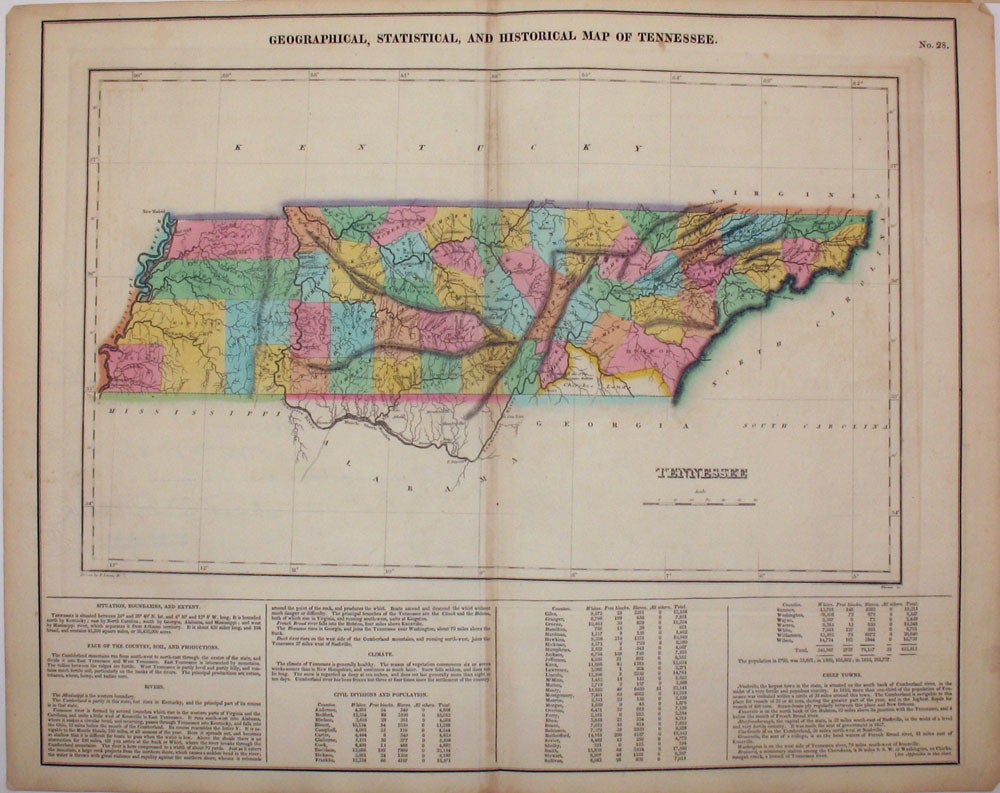
Geographical, Statistical, and Historical Map of Tennessee.
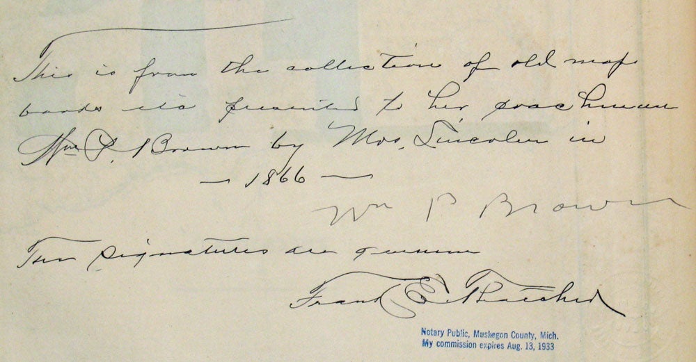
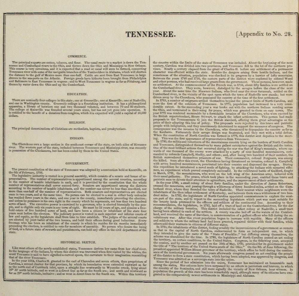
Philadelphia: Carey & Lea, 1823. First edition. Fine original hand colored map of Tennessee from the first edition of Carey and Lea's 'A Complete Historical, Chronological, and Geographical American Atlas, being a Guide to the History of North and South America, and the West Indies to the Year 1822', the best atlas of nineteenth century America. Colors bright and fresh, great detail, a very vibrant, strong impression. With text below map and at both sides, pertaining to topography, climate, lands, towns, roads and canals, education, government and history. With a numerical list under “Civil Divisions and Population” of 'Whites, Free blacks, Slaves, All others' by county. This map, according to History Detectives (Season 6, Episode 4: Lincoln Forgery) was evidently part of an Abraham Lincoln memorabilia scam in which a forger named Harry Sickles worked with Eugene Field II to pass off items in Field's collection as Lincoln items. Sickles and Field managed to convince William P. Brown, the still living coachman of Abraham Lincoln, that they wanted his signature on the verso of their items. Brown's signature, and the notary's signature are genuine; the text referring to the map being given by Mrs. Lincoln to Brown in 1866 was added by the forger. This is the handwritten note on the verso: "This is from the collection of old books, papers, maps, etc presented to her coachman, Wm. P Brown, by Mrs. Lincoln in 1866. (Signed) Wm P Brown. The signatures are genuine. (Signed) Frank E. Thatcher". There is a blue notary stamp, (Muskegon County, Mich. 1933) and a circular blind stamp. Howes C133. Image size: 20 3/4 x 16 1/2" on paper 22 1/4 x 17 1/2" Very good condition. Item #21783
Price: $500.00