
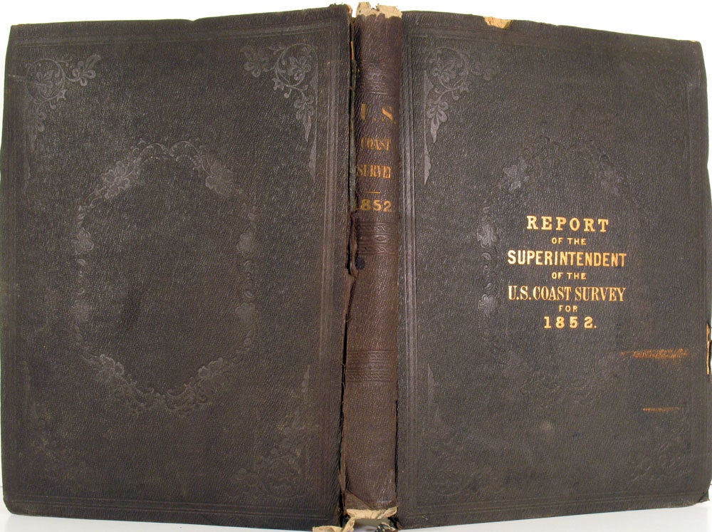
Report of the Superintendent of the Coast Survey, Showing the Progress of the Survey During the Year 1852. Cornelius Clarkson Vermeule's copy.
Washington DC: Robert Armstrong, Public Printer, 1853. Hardcover. Complete volume with all the maps, the Coast Survey for 1852, the personal copy of Cornelius Clarkson Vermeule, the topographer who undertook the first large scale topographical survey of New Jersey. Includes maps and charts extending from the Atlantic coast's Davis' South shoal (off Nantucket, Massachusetts) down to the Gulf and Galveston Bay, and of the California coast including San Francisco.
"The City of San Francisco and its Vicinity" plan extends from Point San Quentin up to Tonquin Shoal, and shows all the wharfs and street grid laid out. The San Clemente Harbor and Cuyler's Harbor map with two engraved views of the harbors by William Birch McMurtrie (1816 - 1872) (J. No. 5), and 17 additional McMurtrie engraved views at 'Western coast from San Francisco to San Diego' (J. No. 9).
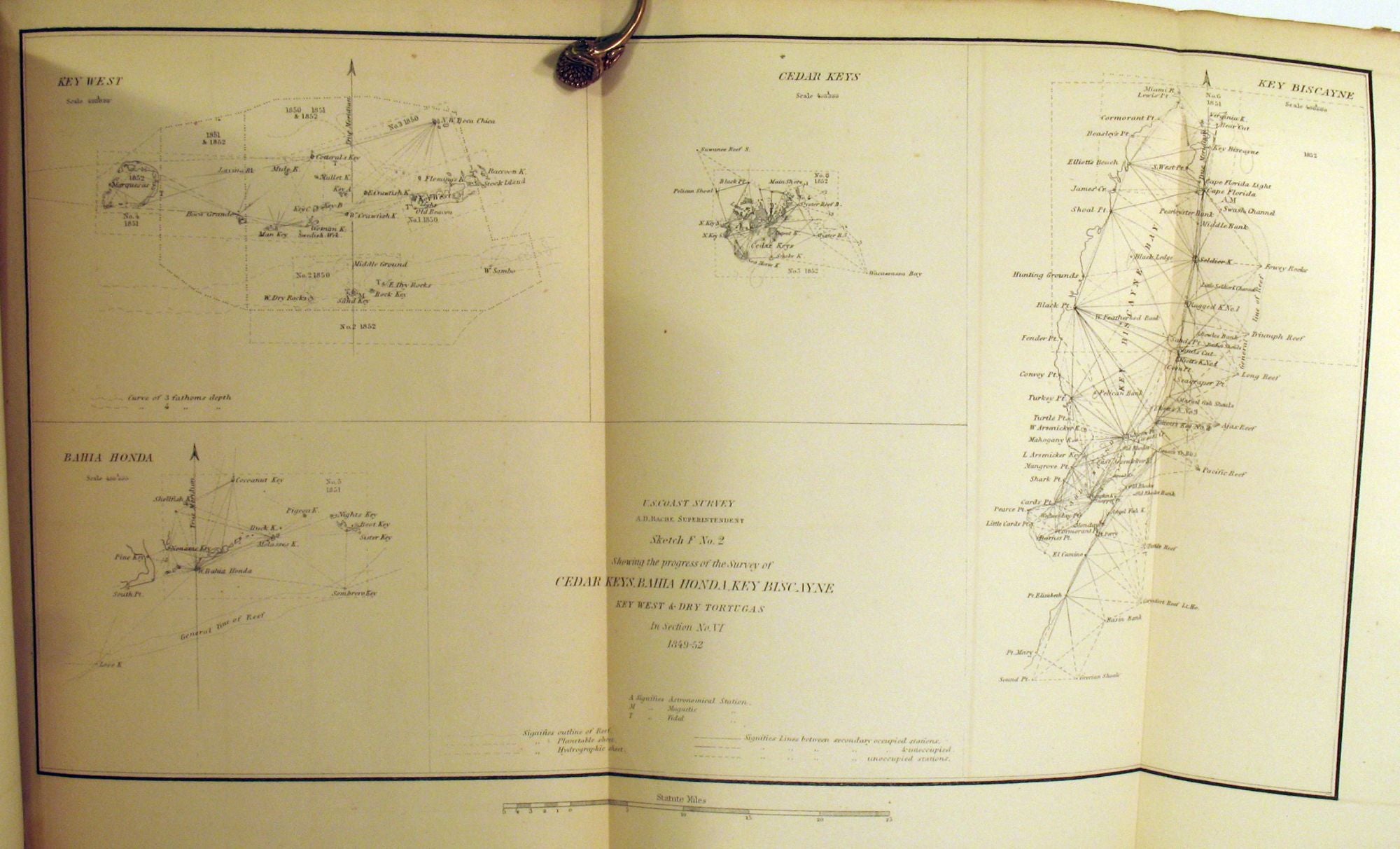
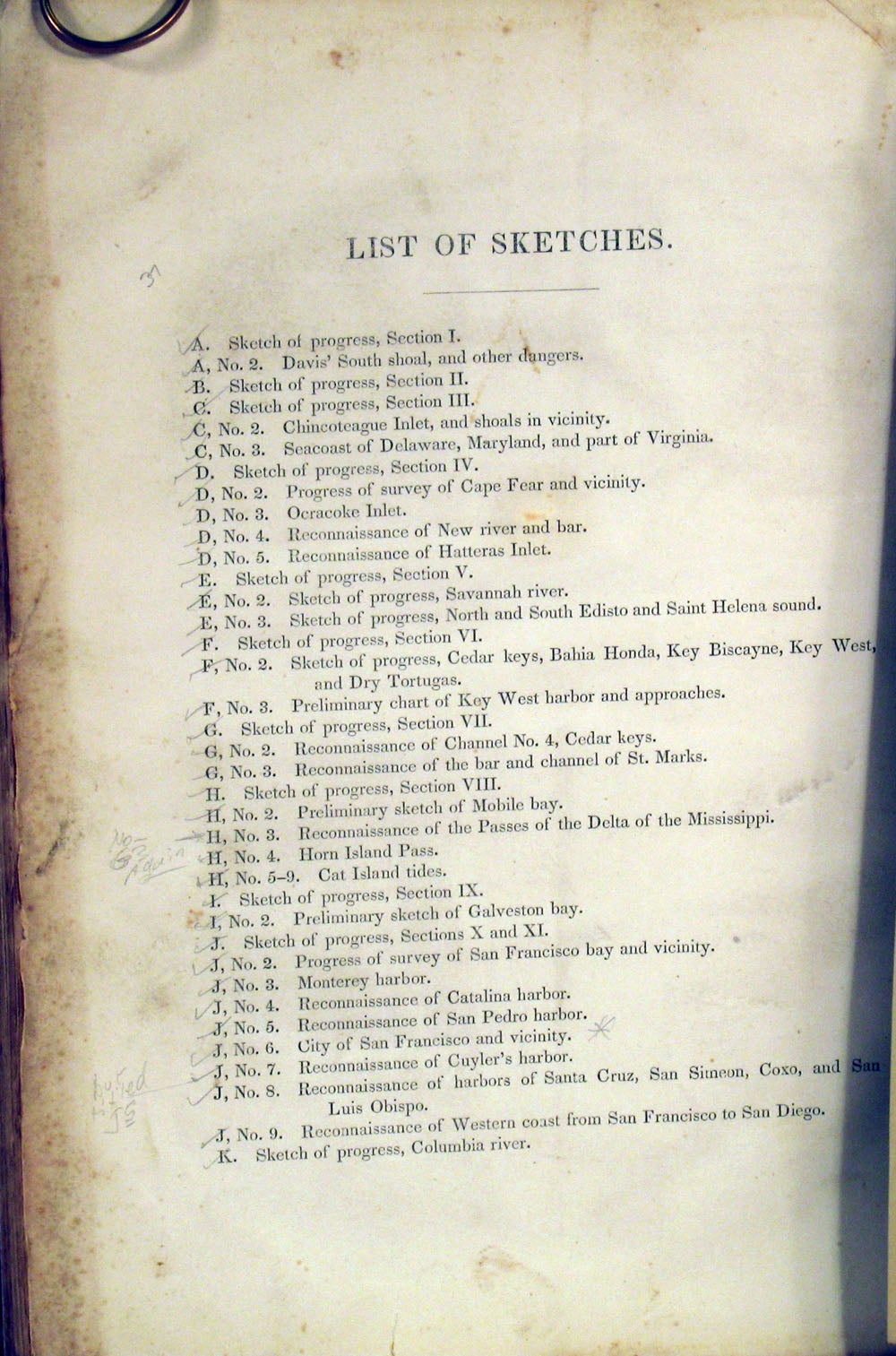
The maps and charts include these named locations: Davis' South shoal, Chincoteague Inlet, Seacoast of Delaware, Maryland, and part of Virginia, Cape Fear, Ocracoke Inlet, New River, Hatteras Inlet, Savannah River, North and South Edisto and Saint Helena Sound, Cedar Keys, Bahia Honda, Key Biscayne, Key West and Dry Tortugas, Key West Harbor, St. Marks, Mobile Bay, Horn Island Pass, Cat Island tides, Galveston Bay, San Francisco Bay and Vicinity, Monterey Harbor, Catalina Harbor, San Pedro Harbor, City of San Francisco and Vicinity, Cuyler's Harbor, Harbors of Santa Cruz, San Simeon, Coxo and San Luis Obispo, Western coast from San Francisco to San Diego, and Columbia River.
The map numbered G, No. 3, "Reconnaissance of the Bar and Channel of St. Marks" appears twice, both at its intended location and again at H, No. 3 (Reconnaissance of the Passes of the Delta of the Mississippi"), evidently a printer's error.
4to, vi, [4], [3]-173pp, [3] pages, [37] folded leaves of plates. Black gilt stamped buckram, with gilt title at front board and spine. Corners bumped, spine ends chipped and cloth split along spine edges. Internally, blank ownership plate laid down at front paste down, ownership stamp 'C. C. Vermeule' at ffep. Cornelius Clarkson Vermeule was a topographer who undertook the first large scale topographical survey of New Jersey. The folding maps in very good condition; the California maps especially bright and clean. OCLC: 8352527. Very good overall. Item #21889
Price: $1,750.00