
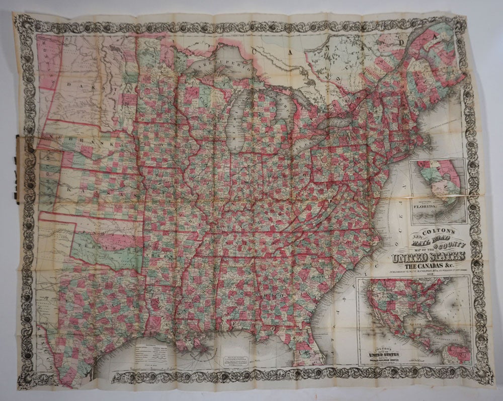
Colton's New Railroad and County Map of the United States, Canadas, & c. Folding pocket map.
New York: G. W. & C. B. Colton & Co, 1869. Published the year that the first transcontinental railroad was completed
Map of the United States as far west as Kansas, with inset "Colton's Map of the United States Showing the Proposed Railroad Routes To The Pacific Ocean", and inset "Southern Part Of Florida". The map (28x41") showing Indian Territory which today consists of the eastern part of Wyoming (territory 1868), Colorado (territory 1861) and Montana (territory in 1864). The projected railroad routes for the Southern Pacific, Atlantic Pacific, and the Northern Pacific are shown, and each county is colored.
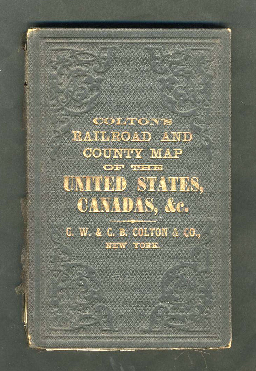
12mo (4 x 6 1/4"), folded into original dark brown stamped cloth covers, with title in gilt at front board. Ads on inside front cover. Numerous short cracks at map folds. Bright gold gilt embossed title at front cover, spine nicely rebacked with the original cloth. Good +. Item #21949
Price: $550.00