
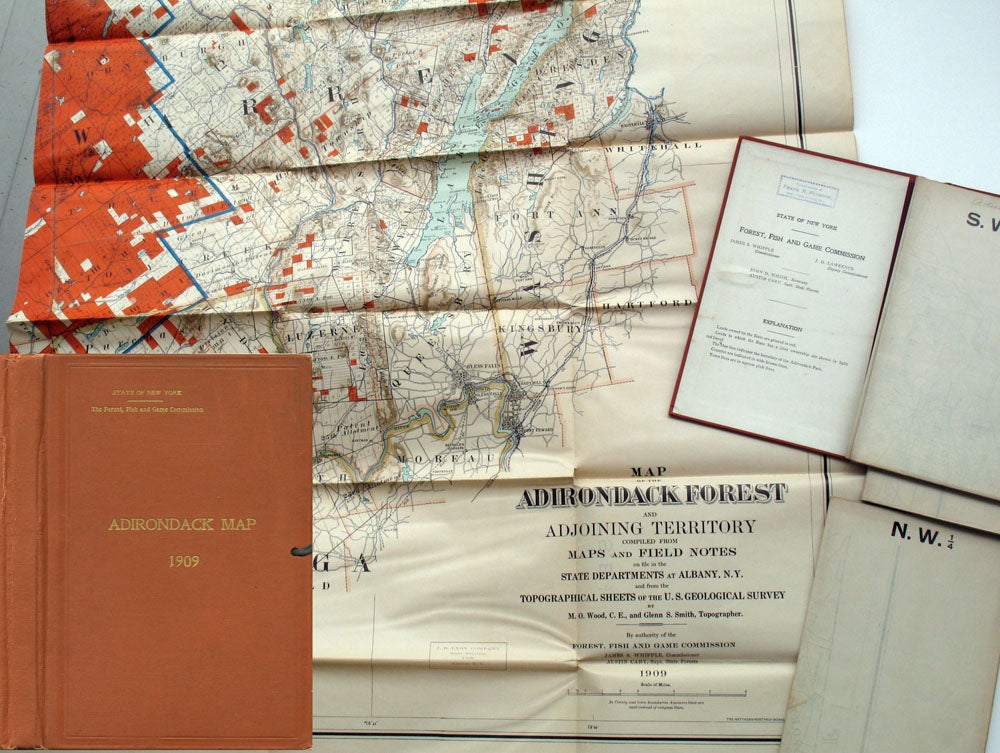
Adirondack Map 1909.
Albany: 1909. It was not until 1894 that the Adirondack Park finally received real protection as an area which would remain "forever wild", following many years of work by Verplanck Colvin, who traveled the area for 3 decades, supervising the state survey and using his annual reports to the New York legislature to push for the creation of an Adirondack Forest Preserve. On these maps the blue line indicates the boundary of the Adirondack Park. With the compliments stamp of Frank R. Pennock, Asst. Clerk of the Assembly at the front pastedown. James A. Whipple is listed as Commissioner, J. D. Lawrence as Deputy Commissioner.
8vo portfolio pocket (6 x 9"), 4 folding colored maps, ca. 36 x 30" each. Shows the state owned lands, extent of the Adirondack Park, railroads, the municipalities, towns, and grants and their subdivisions, roads of the area. Original brick red cloth over boards, gilt title, and black ties. An explanation & Commissioners printed on front pastedown; back pastedown blank, but with a few pencil notations. OCLC: 6893556 records 10 copies. Very good condition. Item #22105
Sold