
Western Australian Maps from Petermann's Geographical Journal published in "Mittheilungen aus Justus Perthes' Geographischer Anstalt," 9 maps from 1862-1881.
Gotha: Augustus Petermann, 1862-1881. A collection of nine maps of Australian exploration from Petermann's Journal, from 1862 to 1881. Augustus Petermann studied and worked with famous German and English cartographers in the 1840's, and eventually established his Geographical Journal in 1855, which is published to this day. Through his association with the Royal Geographical Society in London and later as the first head of the Geographical Institute in Gotha, he had extensive correspondence with a large number of explorers and travelers, who contributed the very latest information for the "Journal". His contacts from his R.G.S. days lead to many Australian explorations being reported in his "Journal" and nowhere else (eg. Lefroy 1864). The Petermann Ranges, in the west of South Australia, are named after him. Petermann's maps included much topographical and water system detail and were used to update such atlases as Stieler Hand Atlas. In 1869 Petermann encouraged the German push on the North Pole, organizing 2 expeditions. All maps are lithographs printed in color.
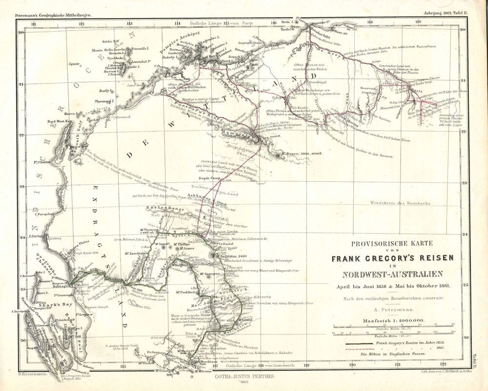
[1862]. Provisorische Karte von Frank Gregory's reisen in Nordwest-Australien April bis June 1858 & Mai bis Oktober 1861. 9 3/4 x 8". WA from Sharks Bay to Cape Larry. (7)
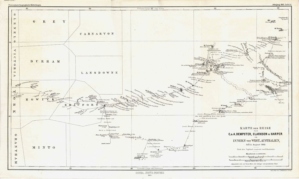
[1863]. Karte der Reise von C. & A. Dempster, Clarkson & Harper innern von West Australien Juli & August 1861. 17 x 10". From York to Lake Grace & Mt. Kennedy. Much detail of an expedition that was never published in English. (9)
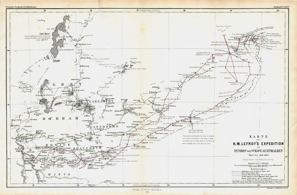
[1864]. Karte von H.M. Lefroy's Exploration innern von West-Australien Mai bis Juli 1863. 15 1/4 x 10". York to Mt. Robinson with Lake Moore in the top left corner. Never published in English. (10)
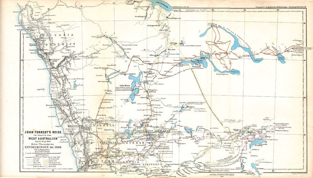
[1869]. John Forrest's Reise im Innern von West-Australien April-Mai 1869. Nebst Ubersicht der Entdeckungen bis 1869. 17 x 10 1/2". Printed outline color. Perth to Murchison River inland to Hampton Plains and Lake Lefroy. Expedition routes include Forrest, AC Gregory, Dale, Austin, Roe, C & A Dempster, Moore, Lefroy & Robinson, F. Gregory, Hunt, Helpman. (20)
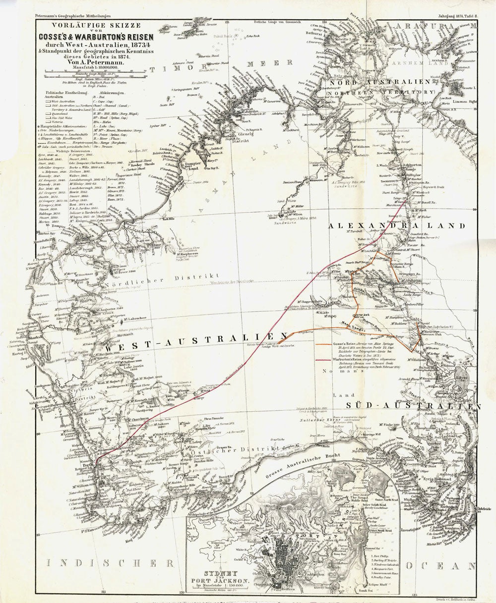
[1874]. Vorlaufige Skizze von Gosse's & Warburton's Reisen durch West-Australien 1873-4 & Standpunkt der Geographischen Kenntniss dieses Gebietes in 1874. 10 1/2 x 13". Warburton's route from Perth to the overland telegraph, inset of Sydney. (24)
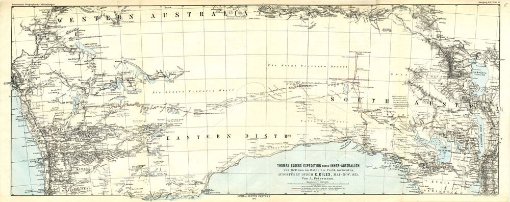
[1874]. Thomas Elders' Expedition durch Inner-Australien von Beltana im Osten bis Perth im Western ausgefuhrt durch E. Giles Mai-Nov 1875. 26 x 10 1/2". SW Australia from Bunbury to Adelaide in the south, upper Murchison to north of Lake Eyre in the north. Very unusual projection, water and sea outlined in blue. (26)
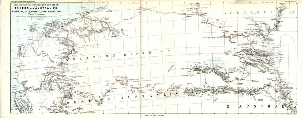
[1876]. Die Neuesten Entdeckung-reisen im Innern von Australien von Warburton Giles Forrest April 1873-Sept 74. 25 3/4 x 10". Sharks Bay to 90 Mile Beach over to Alice Springs. Much geographical detail on the inland exploration. (27)
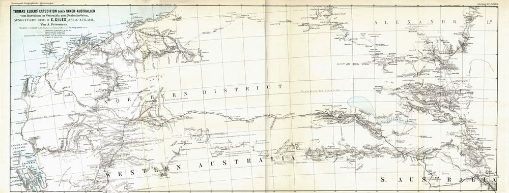
[1877]. Thomas Elders' Expedition durch Inner-Australien von Murchison im Westen, bis zum Neales im Osten, Ausgefuhrt durch E. Giles, April-Aug 1876. The map illustrates Ernest Giles 2nd expedition across Australia. The explorers' routes marked include Warburton, April 15, 1873 to January 26, 1874; Giles: August 1873 to June 1874; Forrest: April 22 to September 27, 1874. It shows Western Australia from Shark's Bay north to 80 Mile Beach, just beyond present site of Port Hedland and east to Mt. Browne in South Australia. The Petermann Ranges feature just into South Australia, named for the cartographer/publisher, Augustus Petermann. 26 x 10".
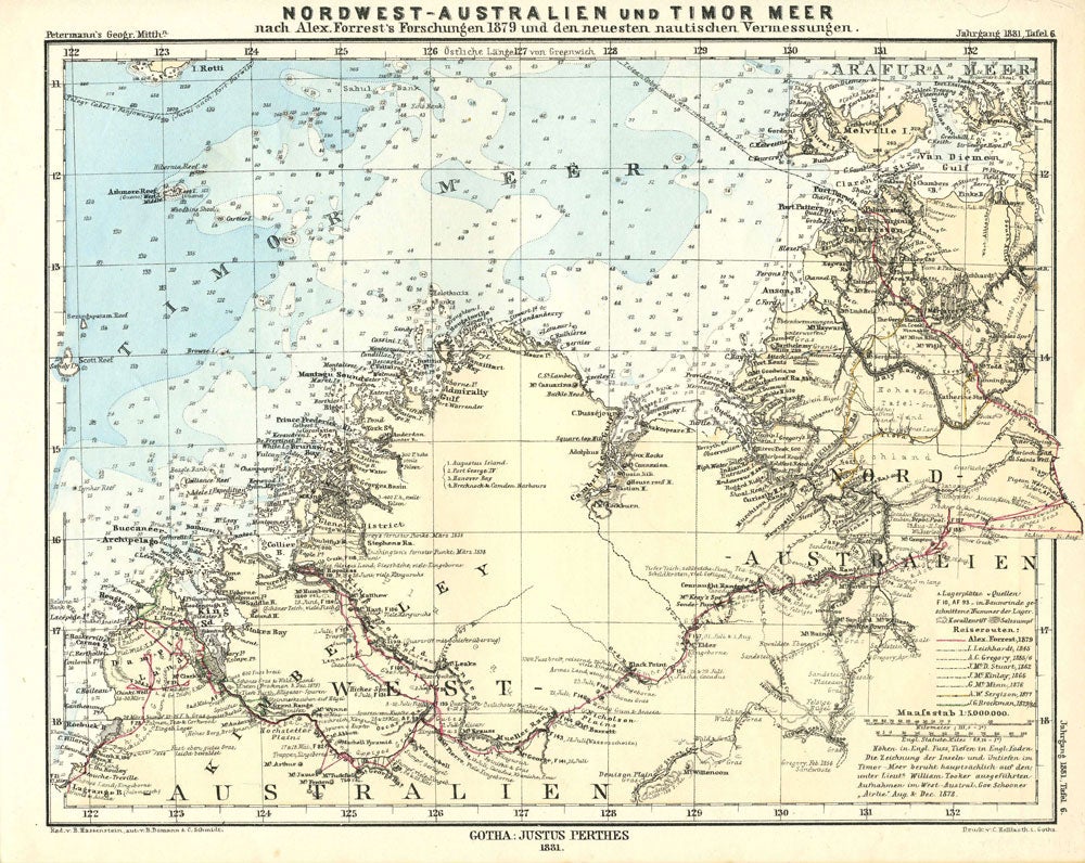
[1881]. Nordwest-Australien und Timor Meer nach Alex Forrest's Forschungen 1879 und den Neuesten Nautischen Vemessumgen. 10 x 8". Outlines explorations by A. Forrest 1879; L. Leichhardt 1845; A. C. Gregory 1855-6; J. McD. Stuart 1862; J. McKinlay 1866; G. McMinn 1876; A. W. Sergison 1877; J. G. Brockman 1879-80. Map from south of Roebuck Bay -Coburg Peninsula. Towns and names in English, observations in German. (29). Very good condition. Item #22266
Price: $1,100.00