
The Nullabor Plains and the West Boundary of the Province. Pamphlet.
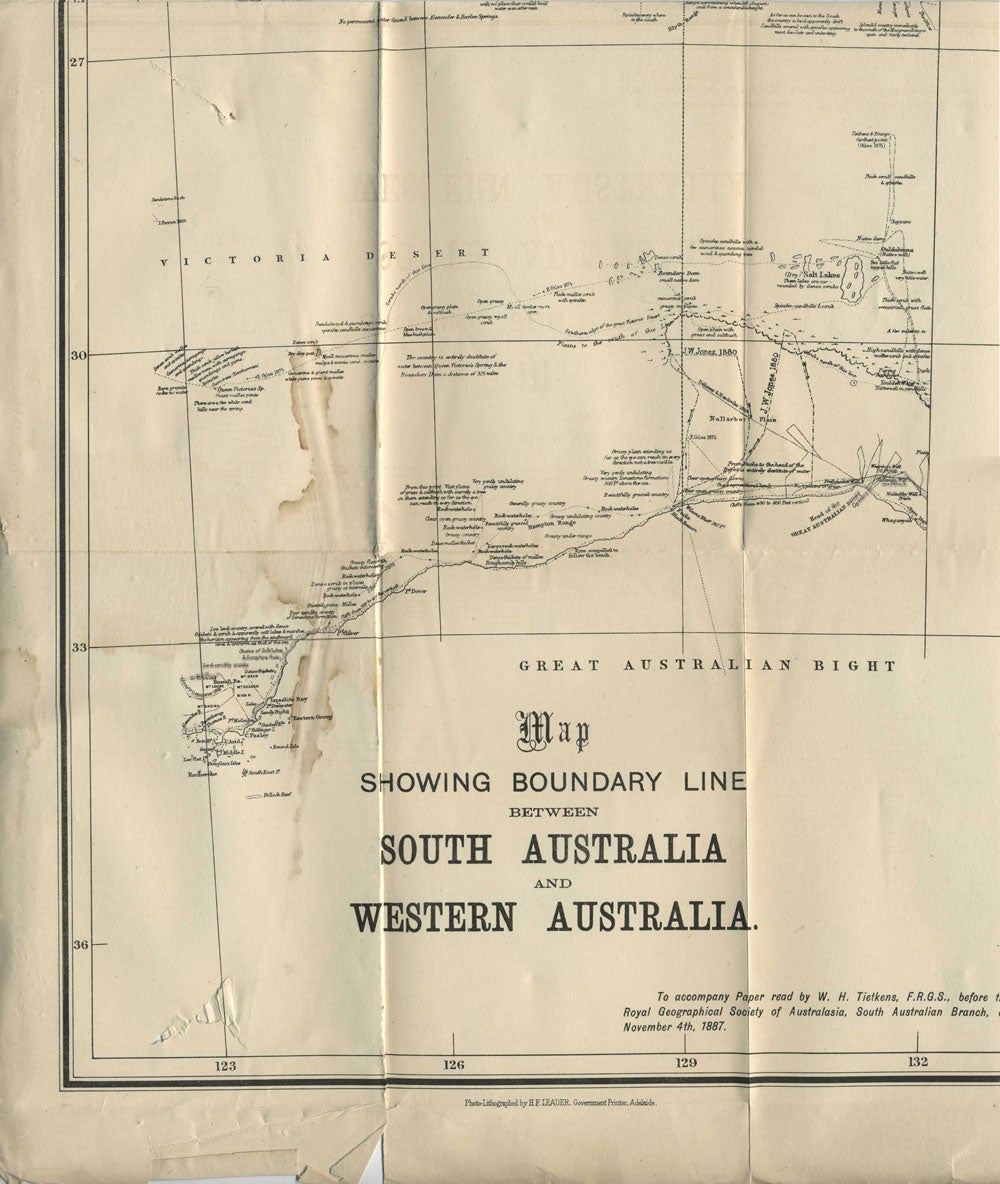
Adelaide: H. F. Leader, Government Printer, 1889. Paperback. The large folding map shows the boundary between South Australia and Western Australia from Bass Strait to Timor. Map includes the routes of Ernest Giles and John Forrest expeditions noting the geography, terrain and journey times.
8vo, 8pp, last blank, folding map. The map and front wrapper loose, as lacks back wrapper; the map has two small closed tears in bottom left blank area repaired archivally, and a mild water stain in the lower left quadrant. Slt. darker marking on top of early pages. Good + overall. Item #22301
Price: $175.00
See all items by W. H. Tietkins