
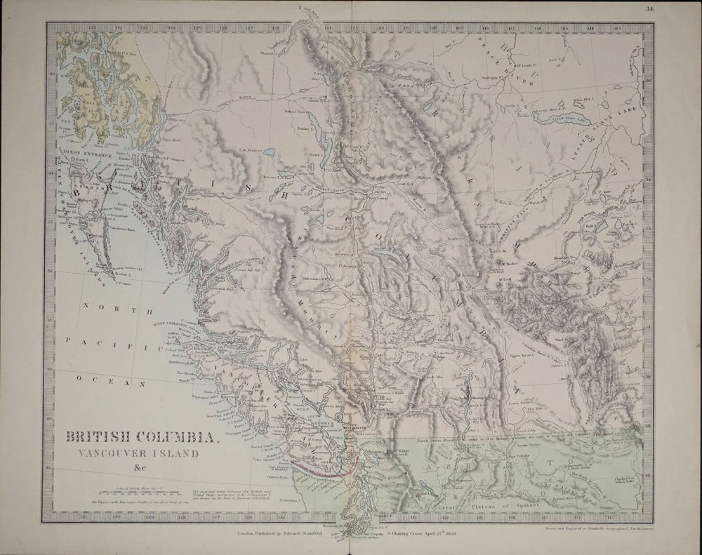
British Columbia, Vancouver Island & c.
London: Edward Stanford, April 27, 1859. A close up map of British Columbia, which includes northern Washington, and goes as far north as Russian America. Vancouver is down at the New Westminster, with Fort Langley slightly further inland on the Fraser River. Northern Washington has a green wash and British Columbia has a red wash; Russian America with a yellow wash. Shows the border as settled in 1846, with an added note that Britain retains the right to navigate the Columbia River.
One original center fold. Slight cracking at top and base of center fold, not into map. 15 1/4 x 13 1/2" Item #22393
Price: $375.00
See all items in
MAPS
See all items by Edward Stanford