
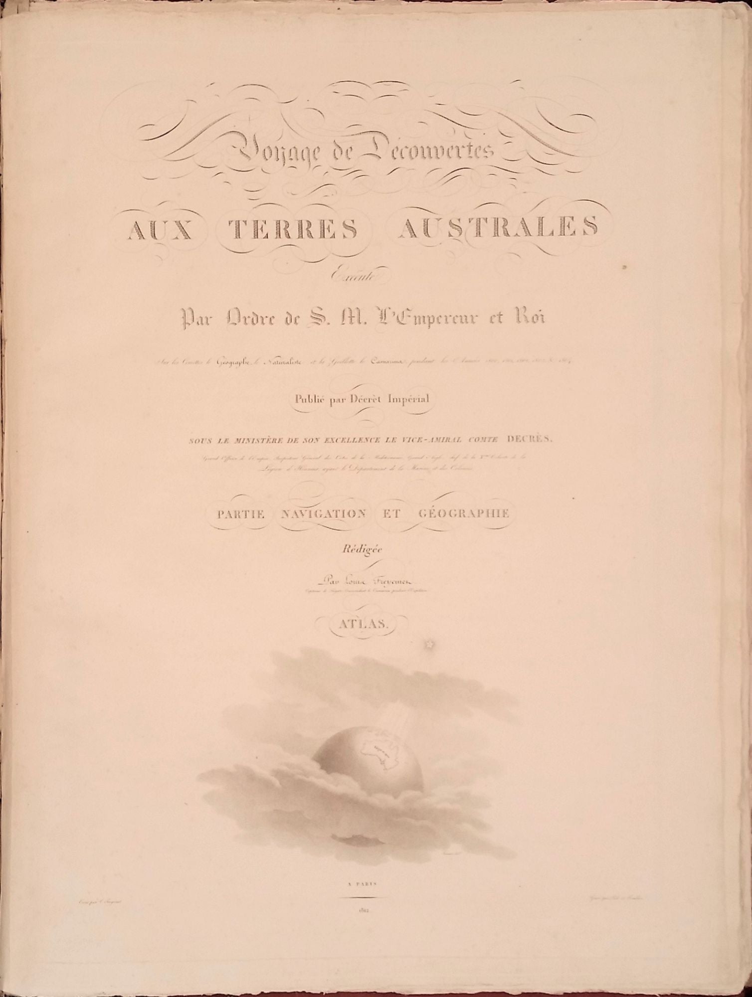
Voyage de Découvertes aux Terres Australes, éxecuté par ordre de Sa Majesté l'Empereur et Roi, sur les corvettes le Géographe, le Naturaliste, et la goelette le Casuarina, pendant les années 1800, 1801, 1802, 1803 et 1804; the COMPLETE SET, described as Ferguson 449, 536 & 603.
Paris: L'Imprimerie Impériale, 1807-1816. First edition. Hardcover. The rare complete official narrative and hydrography of the Baudin-Freycinet Expedition, most volumes in the original papered boards and all uncut. To quote Rodney Davidson, it is "among the finest items of Australiana ever published... They recount an outstanding voyage of discovery... In complete form the journals are exceedingly rare".
The expedition was sent out by the French government in 1800 with orders to complete the cartographic survey of the Australian coast. Commanded by Nicolas Baudin, the expedition left France in 1800 and sailed via Mauritius to the Western Australian coast in the region of Cape Leeuwin, arriving in May 1801. Peron sailed as naturalist on the expedition and Freycinet as cartographer. The vessels, Geographe and Naturaliste, sailed north from Cape Leeuwin, charting the mouth of the Swan River, site of present day Perth. After three months in Timor, the two ships set out for Tasmania, continuing to make surveys and a close study of Tasmanian aborigines and their material culture. They continued on to New South Wales, creating a fine panorama of the town of Sydney, as well as views and a town plan. They then undertook a complete survey of the southern coast and an examination of the northern coast before returning to Mauritius where, near the end of 1803, Baudin died. The voyage brought back to France the most important collection of natural history specimens in the history of the French Museum, as well as a wealth of geographical and other information. Many of these specimens were maintained at Malmaison, the chateau of Josephine & Napoleon on the outskirts of Paris.
The narrative of the expedition was begun by Peron, and completed by Freycinet after Peron's death. A tacit agreement between Peron and Freycinet, both of whom disliked Baudin, kept the commander's name mostly absent from the present official account of the expedition. Mathew Flinders completed his survey of the Australian coast on behalf of the English before Baudin, but his imprisonment by the French in Mauritius for seven years resulted in the French exploration account being published first. English concerns for French intentions were justified, but there was an amicable famous meeting of the two expeditions at a bay in South Australia subsequently named Encounter Bay.
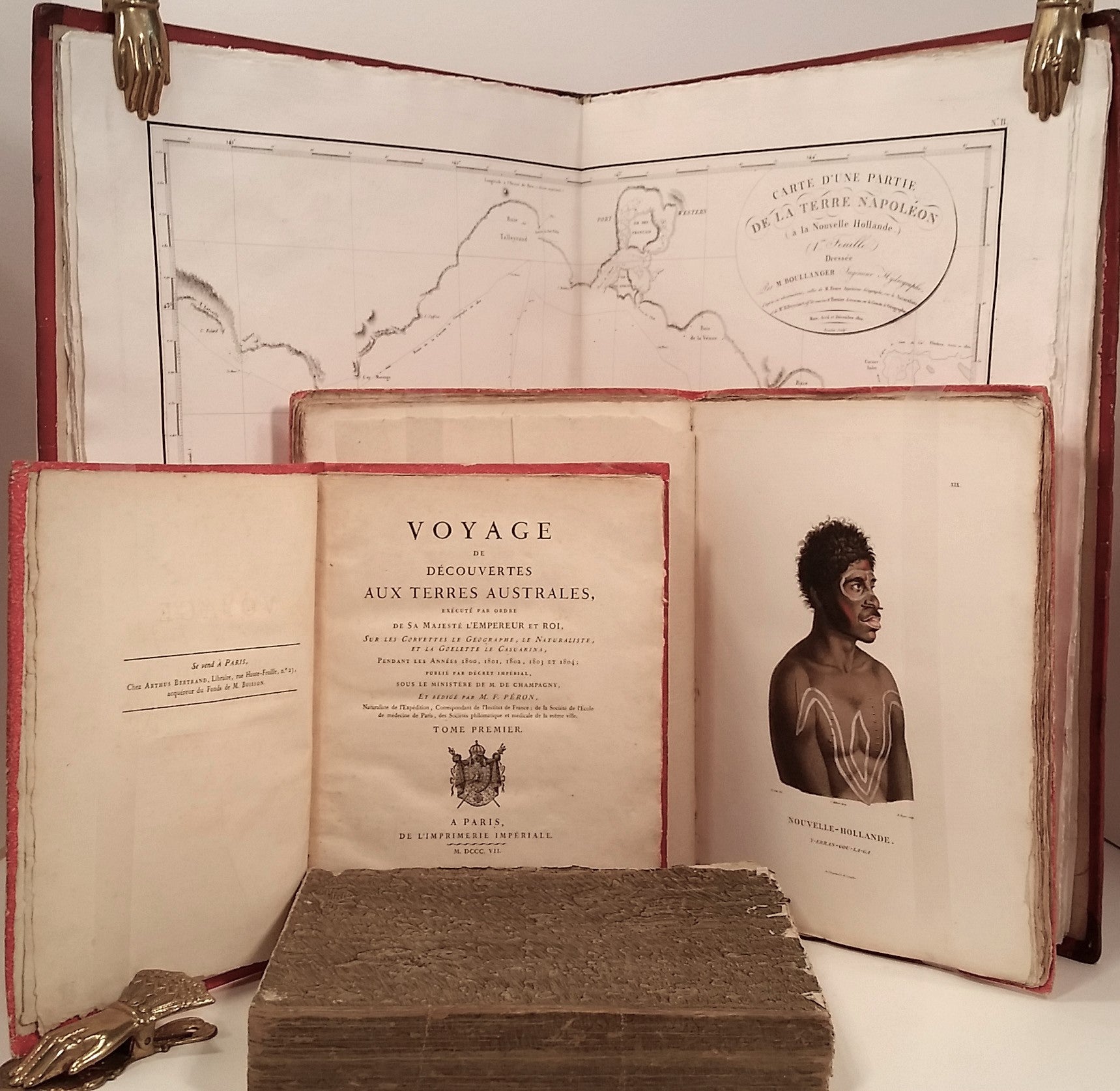
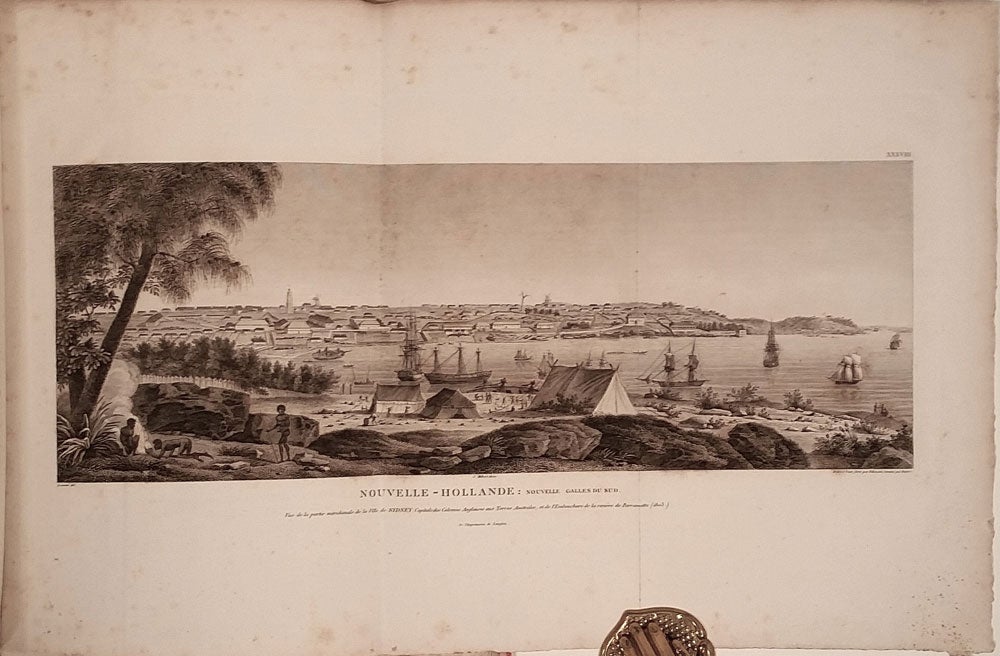
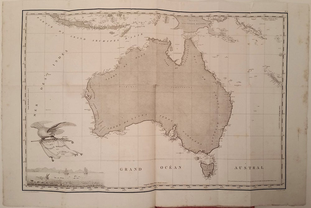
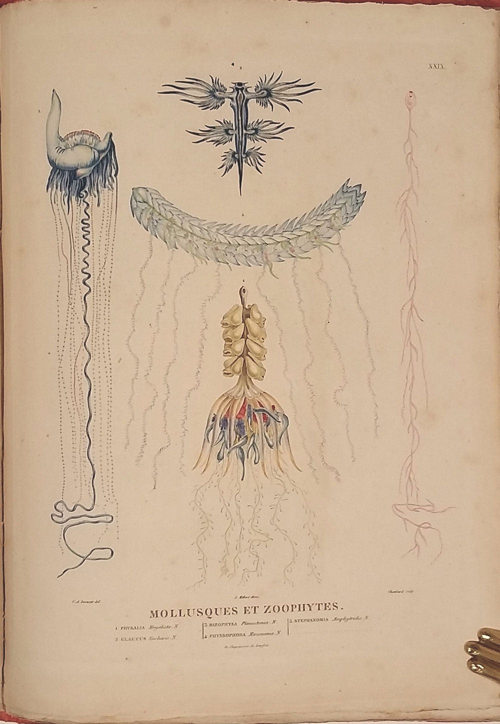
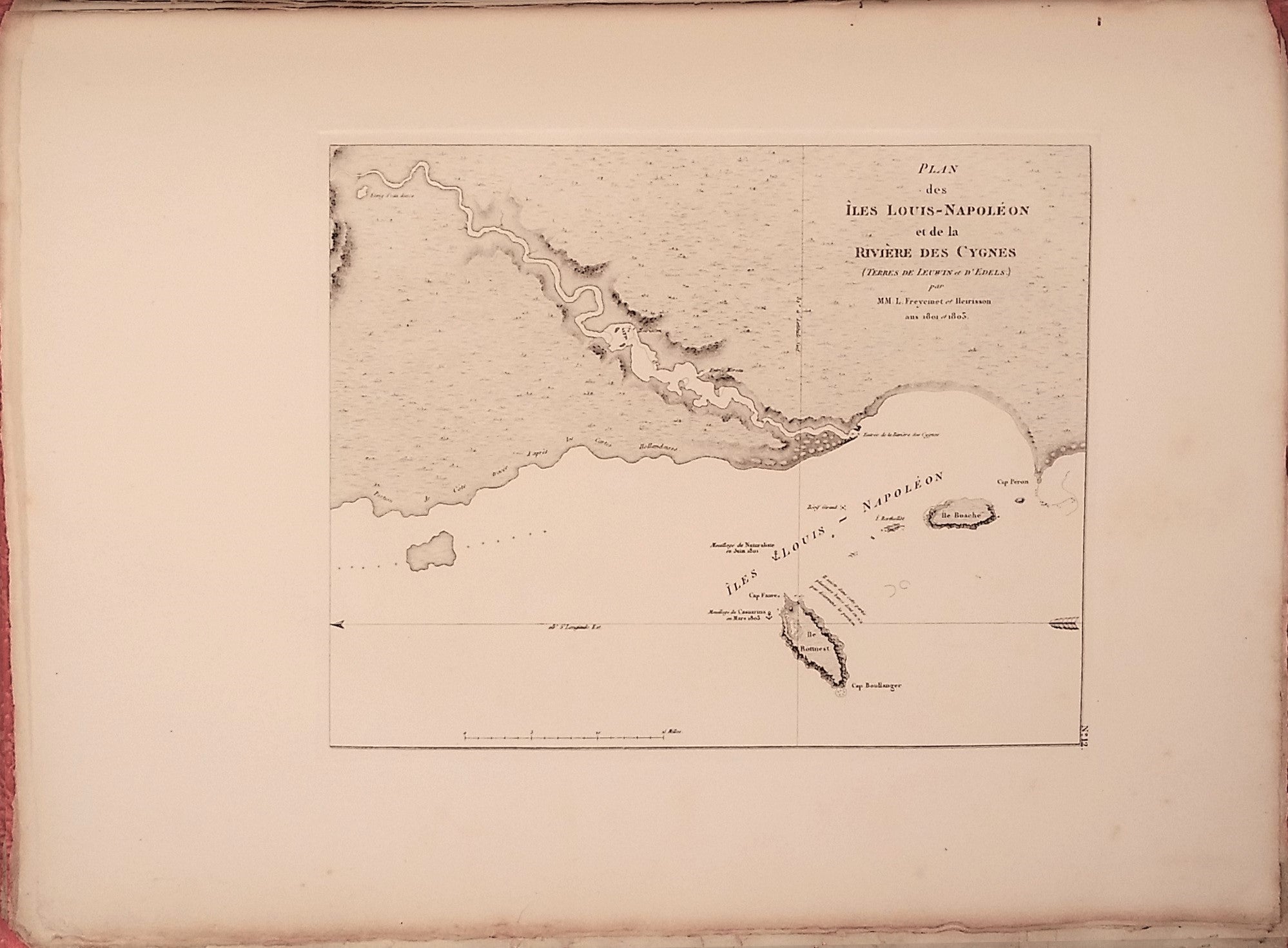
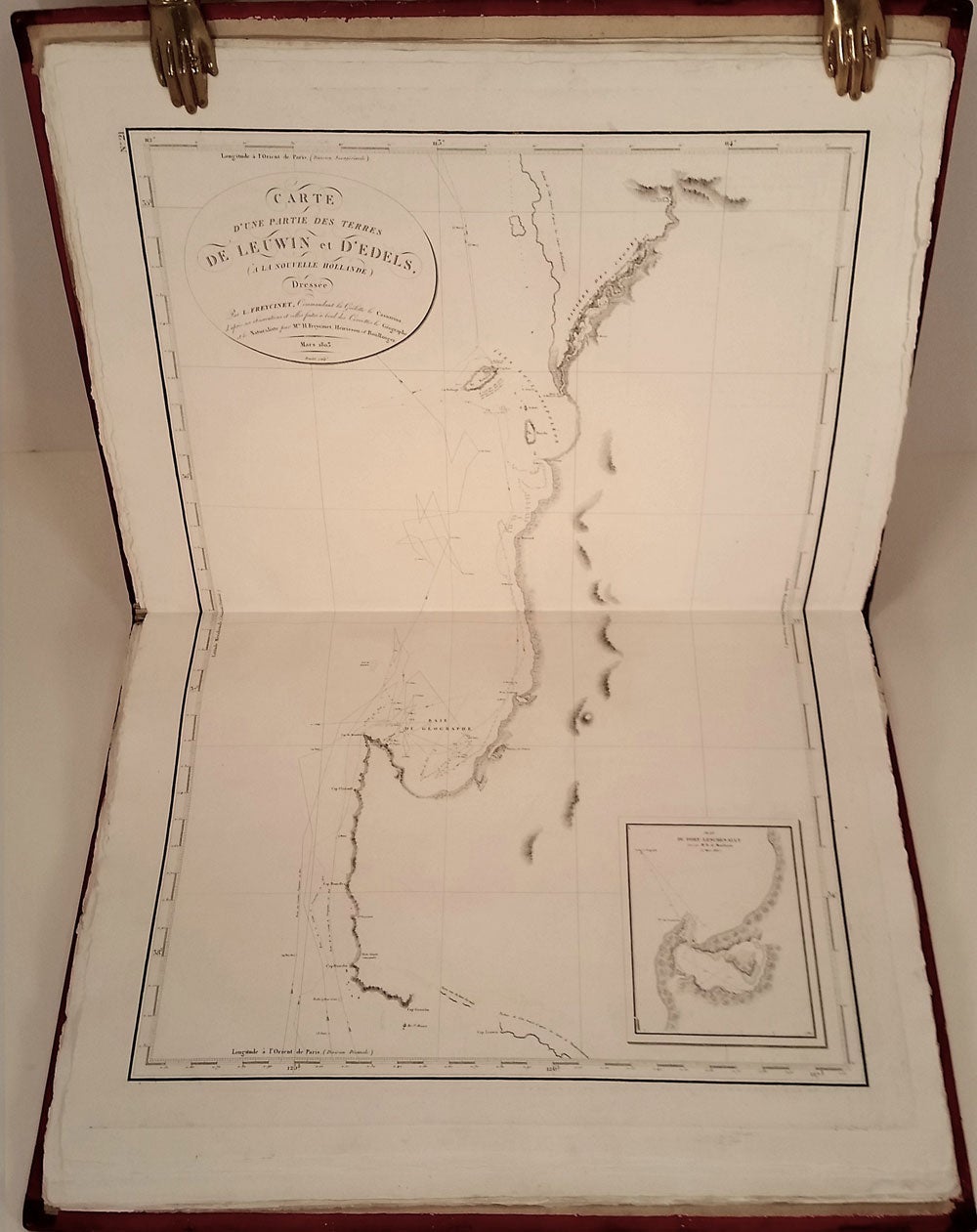
Consequently, the Baudin-Freycinet narrative includes the first complete and fully detailed map of the coastline of the Australian continent. It is a cartographic milestone, artfully done, as exemplified by the French artistry of the time. The southern coast is almost entirely named "Terre Napolean," indicating France's colonial ambitions. A highlight of the numerous plates and maps includes an engraved portrait of Peron, done within days of his death; coastlines of Tasmania, South Australia, Western Australia and Queensland; exquisite natural history plates illustrating the the spectacularly different Australian fauna - kangaroo, wombat, platypus, Tasmanian tiger & emu, many hand-colored; 11 views including two folding, panoramic views of Sydney and Timor; 19 ethnographic portraits, 17 of which are of Tasmanian & New South Wales aborigines with examples of their material culture; charts, coastal profiles, views and plans of Sydney & of islands and harbors around Australia and Timor including Tasmania, Western Australia (including Perth, Albany & Shark Bay); and South Australia.
The Baudin-Freycinet narrative is not always found complete, as the navigational text and atlas were issued on different dates and sold separately from the narrative "Historique." The specialized nature of the navigational section, including the text which constitutes a pilot to the Australian coast, meant that it was not often added to copies of the narrative section. However, as first full atlas of the Australian coastline, its cartographical contribution is of extraordinary value.
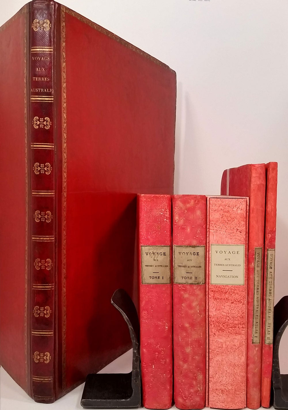
F 449- Historique. 2 volumes 4to text, 2 volumes sml. folio atlas.
Vol 1; Paris, de l'Imprimerie Imperiale, 1807. 4to, pp [4], (i)-xv, (blank) (3), 4-496, 2pp errata. Vol 2; Paris, a l'Imprimerie Royale, 1816. 4to, pp [4], frontispiece portrait, v-xxxi; (blank); (1)-471pp. Original pink papered boards, original cream spine labels, uncut. Bindings of all 4 volumes with some minor restoration.
Atlas volumes; Partie Historique Rédigée par M.F. Peron
Atlas par Mm. Lesueur et Petit. Sml. folio, pp [6] text; original tissue guards, 40 plates, including panoramas of Sydney and Timor, handsome portraits of Australian aborigines, some colored.
Atlas Deuxième Partie, Rédigée par Mr. L. Freycinet… Paris 1811. Sml. folio, pp [6] text; 14 maps & charts, some folding.
Includes as No. 1 the large folding map of the Australian coastline, THE FIRST DETAILED AND COMPLETE MAP OF THE COASTLINE OF THE AUSTRALIAN CONTINENT, in unusually good condition, usually damaged.
A couple of small closed fold line separations; a couple of tiny wormholes near inside hinge. A little scattered minor foxing. Otherwise excellent.
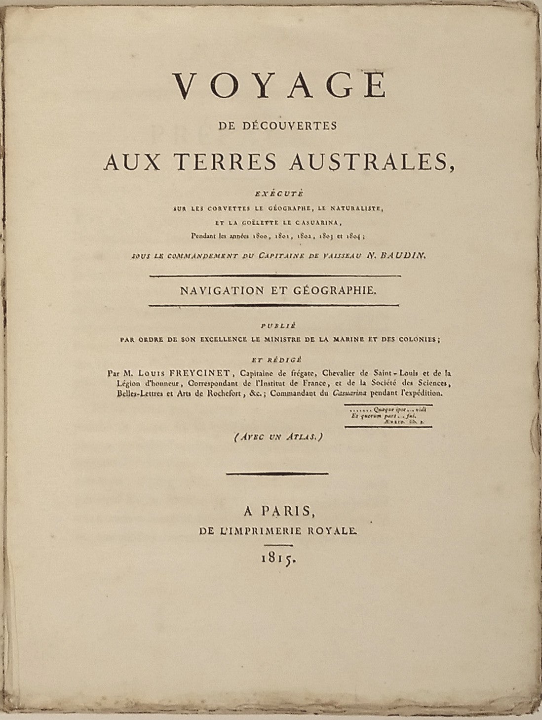
F 603. Navigation et Géographie Rédigée par M. Louis Freycinet…
Paris, De l'Imprimerie Royale, 1815. 4to, pp [4]; v-vxi; (1)-576, 2pp errata, the last half of the text unopened, uncut. Original brown papered wrappers; spine supported with acid free tissue, no title label, housed in a chemise with pink decorated paper, coordinating label & pink papered boards of F 449. Wrapper edges a little ruffled, triangular chip missing from back inside top corner.
F 536. Partie Navigation et Géographie Rédigée par Louis Freycinet… Atlas.
Paris 1812. Imperial folio, pp [4]; 32 charts (25 double-page). Original red diced calf, gilt decorated spine, original red papered boards with gilt border decoration. Uncut. Maps had some foxing and offsetting, now professionally treated; full report available.
REF: Ferguson 449, 563 & 603; Wantrup 78a, 79a , 80a & 81; Hill p. 1329 (Narrative volumes only); Davidson, Book Collector's Notes, pp. 108-110; Sharp, Discovery of Australia, pp.232-39; Dunmore, French Explorers in the Pacific II, pp.9-40; Plomley, The Baudin Expedition and the Tasmanian Aborigines 1802. Very good overall. Item #22691
Sold