
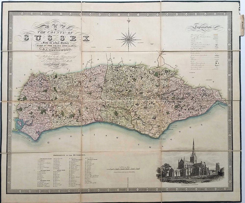
Map of the County of Sussex Made in the Years 1823 ad 1824 by C. & J. Greenwood 1829.
London: Greenwood, Pringle & Co, 1829. Later printing. Large decorative steel engraved survey map of the British county, with original hand color, dissected and mounted on linen. First published March 24th 1825, this is from the same plate but with additions and corrections. With a large vignette illustration of Chichester Cathedral at lower right corner and a compass rose, it shows county boundaries, the parishes and hundreds, market towns, villages, turnpike roads, churches, chapels, castles and priories, heaths, canals, railways, woods, parks, hills, wind and water mills, and rivers & brooks.
Subtitle- Published by the Proprietors, Greenwood & Co. 13, Regent Street Pall Mall, London, Corrected to the Present Period July 4th, 1829. Engraved by H. Frost, Goswell Rd.
The Greenwood brothers, Christopher and John, are recognized for their impressive series of high quality steel engraved large scale folding county maps based on their own surveys, made between 1817 and 1830.
The Sussex map in 12 panels, backed in linen with green silk edging. 29 x 25 1/2". Folds into green marbled paper covers. Very clean and bright. Very good condition. Item #22808
Price: $750.00