
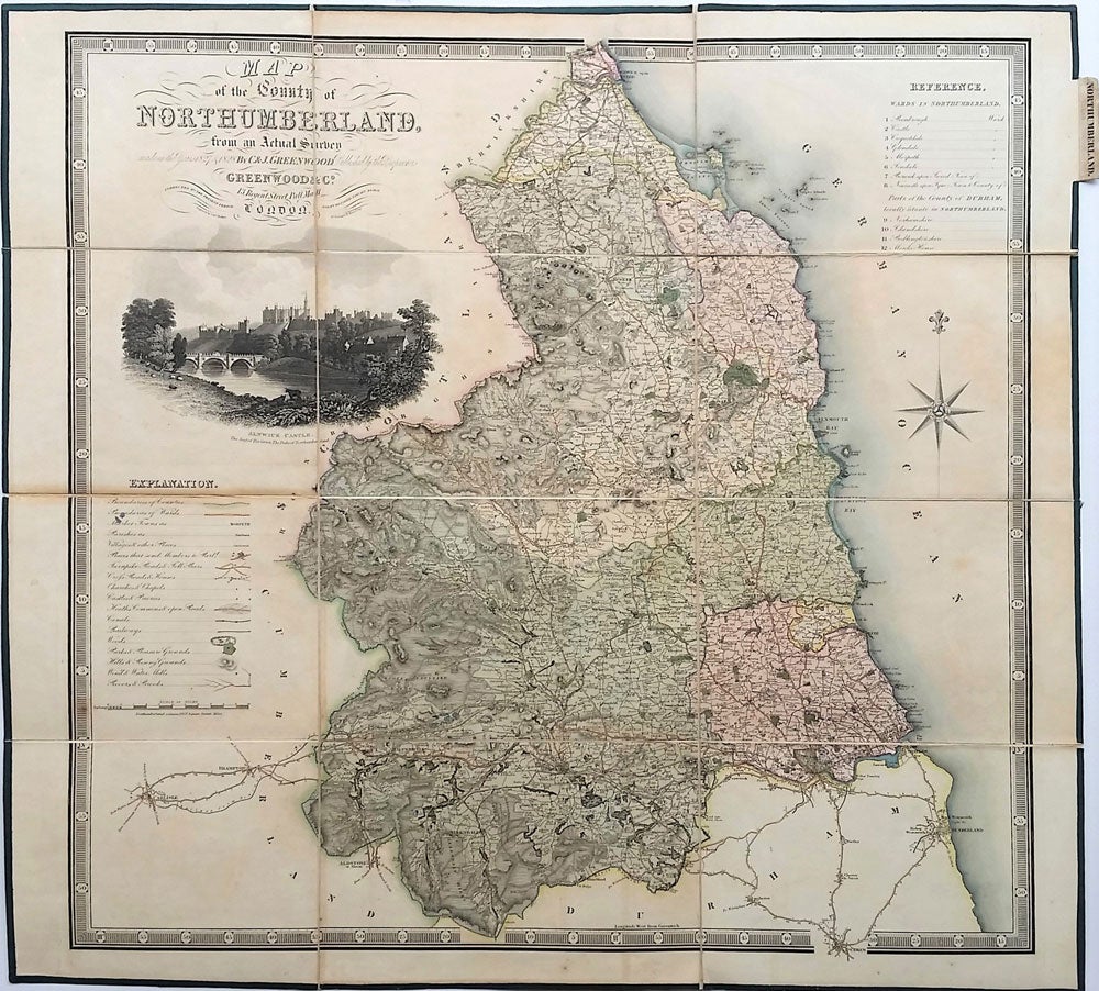

Map of the County of Northumberland, from an Actual Survey made in the years 1827 & 1828.
London: Greenwood & Co., Jan 26th 1831. Later printing. Maps. Handsome steel engraved map with fine original color and later additions. With a detailed and decorative vignette view of Alnwick Castle at the upper left. Showing the wards of Northumberland and parts of Durham situate in Northumberland. Also showing county boundaries, the parishes and hundreds, market towns, villages, turnpike roads, churches, chapels, castles and priories, heaths, canals, railways, woods, parks, hills, wind and water mills, and rivers & brooks.
The Greenwood brothers, Christopher and John, are recognized for their impressive series of high quality steel engraved large scale folding county maps based on their own surveys, made between 1817 and 1830.
27 x 26". 12 panel map in presentation form laid on canvas with green silk borders. Folds into green marbled paper covers. Fine. Item #22809
Sold