
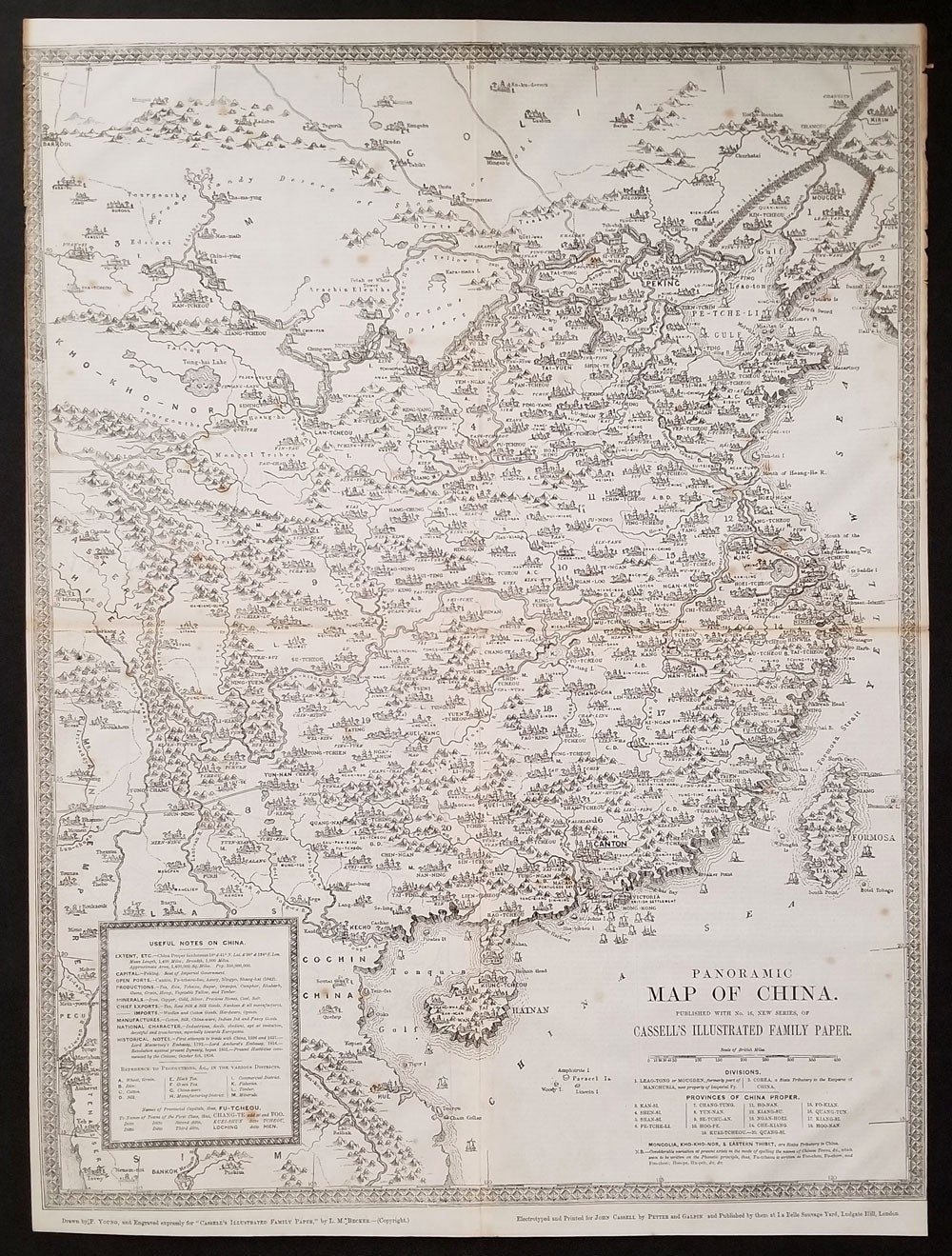
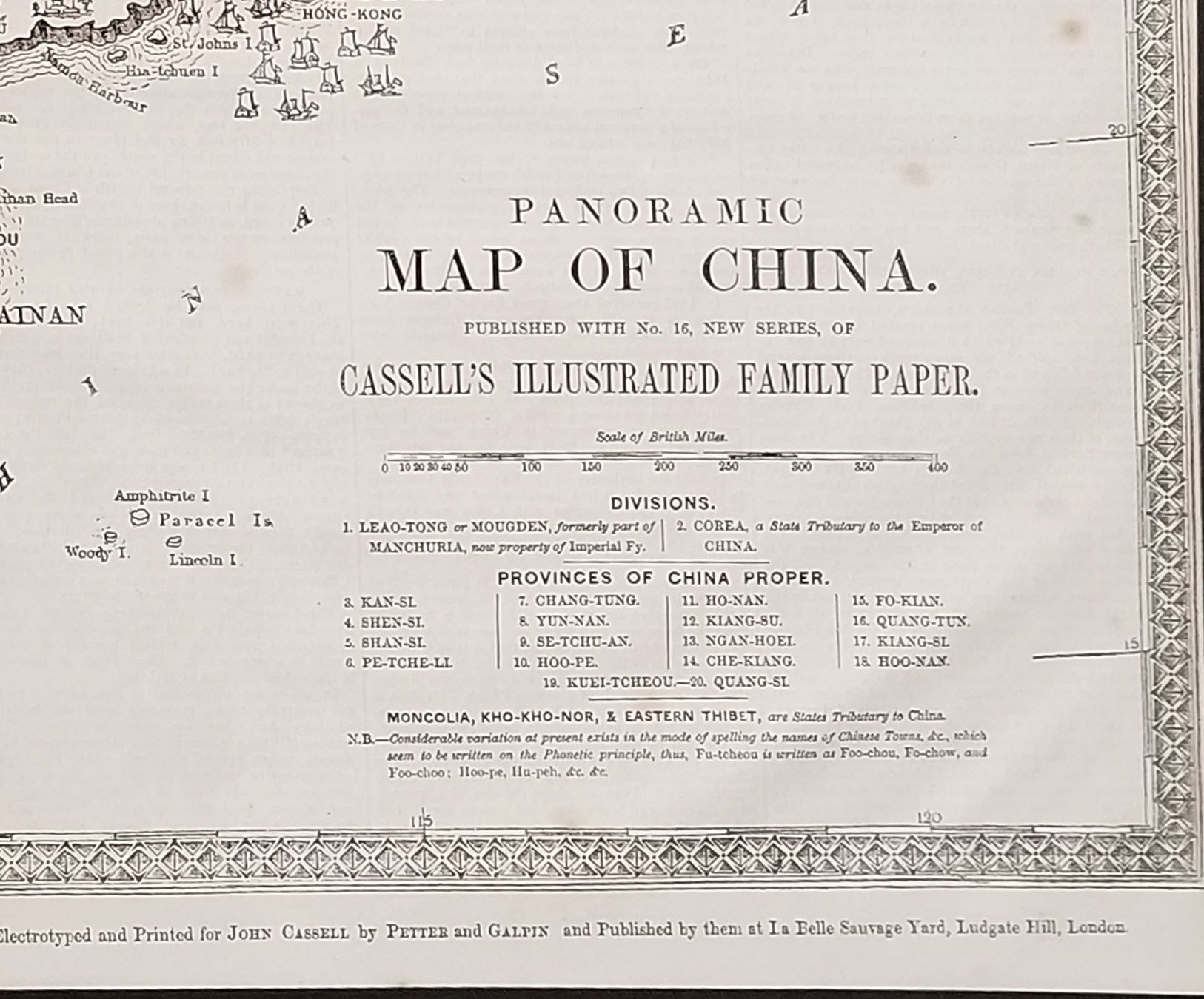
Panoramic Map of China.
London: John Cassell by Petter and Galpin, 1858. First edition. Map of China created during the Second Opium War. With "Useful Notes on China" printed on the front lower left, and a history of China on the verso.
Published with No. 16, New Series, of Castle's Illustrated Family Paper. Place names include "Victoria, British Settlement" above "Hong Kong"; Macao, Portuguese Settlement; Canton; Amoy; Shanghai, Nanking, Peking. Includes many Chinese towns, as well as Formosa (Taiwan). Mountains, rivers, roads, buildings & temples, the Great Wall, called "Palisades"; a canal near Tchang; The northern border is the Great Sandy Desert in Mongolia, in the west it extends to Eastern Tibet; southern edge to Bangkok.
Under "Historical Notes"- "The present hostilities commenced by the Chinese October 8th, 1856." Includes markings for "productions in the various districts" black tea, green tea, silk, rice, fisheries, etc."
Woodblock, 16 x 21", contemporary folds, small hole at fold intersection at center.
Scarce supplement, which would undoubtedly be missing from issues of this scarce journal. Very good condition. Item #23655
Sold